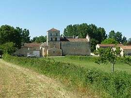
Saint-Amant-de-Bonnieure
Saint-Amant-de-Bonnieure is a former commune in the Charente department in southwestern France. On 1 January 2018, it was merged into the new commune of Val-de-Bonnieure.[1]
Saint-Amant-de-Bonnieure | |
|---|---|
Part of Val-de-Bonnieure | |
 | |
 Coat of arms | |
Location of Saint-Amant-de-Bonnieure 
| |
 Saint-Amant-de-Bonnieure  Saint-Amant-de-Bonnieure | |
| Coordinates: 45°51′11″N 0°17′39″E | |
| Country | France |
| Region | Nouvelle-Aquitaine |
| Department | Charente |
| Arrondissement | Confolens |
| Canton | Boixe-et-Manslois |
| Commune | Val-de-Bonnieure |
| Area 1 | 10.67 km2 (4.12 sq mi) |
| Population (2008) | 346 |
| • Density | 32/km2 (84/sq mi) |
| Time zone | UTC+01:00 (CET) |
| • Summer (DST) | UTC+02:00 (CEST) |
| Postal code | 16230 |
| Elevation | 65–129 m (213–423 ft) (avg. 73 m or 240 ft) |
| 1 French Land Register data, which excludes lakes, ponds, glaciers > 1 km2 (0.386 sq mi or 247 acres) and river estuaries. | |
Population
| Historical population | ||
|---|---|---|
| Year | Pop. | ±% |
| 1793 | 773 | — |
| 1800 | 1,153 | +49.2% |
| 1806 | 835 | −27.6% |
| 1821 | 891 | +6.7% |
| 1831 | 870 | −2.4% |
| 1841 | 861 | −1.0% |
| 1846 | 857 | −0.5% |
| 1851 | 868 | +1.3% |
| 1856 | 860 | −0.9% |
| 1861 | 861 | +0.1% |
| 1866 | 801 | −7.0% |
| 1872 | 692 | −13.6% |
| 1876 | 705 | +1.9% |
| 1881 | 753 | +6.8% |
| 1886 | 693 | −8.0% |
| 1891 | 688 | −0.7% |
| 1896 | 651 | −5.4% |
| 1901 | 661 | +1.5% |
| 1906 | 636 | −3.8% |
| 1911 | 605 | −4.9% |
| 1921 | 556 | −8.1% |
| 1926 | 556 | +0.0% |
| 1931 | 480 | −13.7% |
| 1936 | 475 | −1.0% |
| 1946 | 446 | −6.1% |
| 1954 | 410 | −8.1% |
| 1962 | 389 | −5.1% |
| 1968 | 357 | −8.2% |
| 1975 | 309 | −13.4% |
| 1982 | 315 | +1.9% |
| 1990 | 297 | −5.7% |
| 1999 | 315 | +6.1% |
| 2008 | 346 | +9.8% |
See also
References
- Arrêté préfectoral 7 November 2017 2017 (in French)
| Wikimedia Commons has media related to Saint-Amant-de-Bonnieure. |
| Authority control |
|
|---|
This article is issued from Wikipedia. The text is licensed under Creative Commons - Attribution - Sharealike. Additional terms may apply for the media files.