Sabie River
The Sabie River[2][3] is a river in South Africa that forms part of the Komati River System.[4] The catchment area of the Sabie-Sand system is 6,320 km2 in extent.[5] The Sabie is one of the most biologically diverse rivers in South Africa, with generally good water quality.[6]
| Sabie River | |
|---|---|
 Sabie River east of Skukuza | |
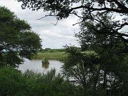
 The Sabie River in the Komati catchment (center) | |
| Etymology | From the word for 'sand' in the Tsonga language[1] |
| Location | |
| Country | South Africa, Mozambique |
| Province | Mpumalanga |
| Physical characteristics | |
| Source | |
| ⁃ location | Mount Anderson, Lydenburg, South Africa |
| ⁃ elevation | 1,100 m (3,600 ft) |
| Mouth | Komati River |
⁃ location | Maputo Province |
⁃ coordinates | 25°19′52″S 32°17′50″E |
| Discharge | |
| ⁃ average | 0 m3/s (0 cu ft/s) |
| Basin features | |
| River system | Komati River |
| Tributaries | |
| ⁃ left | Sand River |
| ⁃ right | Mac Mac Marite River |
Course
It rises in the Drakensberg escarpment of Mpumalanga province, flowing eastwards into the lowveld.[7] It crosses the breadth of the Kruger National Park before cutting through the Lebombo range into Mozambique.[8] Some 40 km from Moamba it enters the large Corumana Dam[9] before finally joining the Komati. Settlements on its banks include Sabie, Hazyview, Skukuza and Lower Sabie.
Tributaries
Tributaries of the Sabie include:[10]
- Klein Sabie River
- Mac Mac River
- Marite River, its tributary is:
- Ngwaritsana River
- Motitse River
- Mhlambanyatsi River (in Kruger Park)
- N'waswitshaka River (at Skukuza)
- N'watindlopfu Spruit (in Kruger Park)
- N'watinwambu River (in Kruger Park)
- Sabane River
- Sand River (in Kruger Park)
References
- Dictionary of Southern African Place Names
- Exact location of Sabie River
- Ecoregion 5.05 - The Sabie-Sand River System
- Inkomati WMA 5
- http://www.dwaf.gov.za/IWQS/rhp/state_of_rivers/state_of_crocsabieolif_01/sabie_eco.html
- Ecoregion 4.03 - The Sabie-Sand River System
- The Sabie-Sand River System
- Description of Tweefontein plantation
- Corumana Dam
- http://www.dwaf.gov.za/IWQS/rhp/state_of_rivers/state_of_crocsabieolif_01/sabie_eco_5.05.html
| Wikimedia Commons has media related to Sabie River. |
This article is issued from Wikipedia. The text is licensed under Creative Commons - Attribution - Sharealike. Additional terms may apply for the media files.