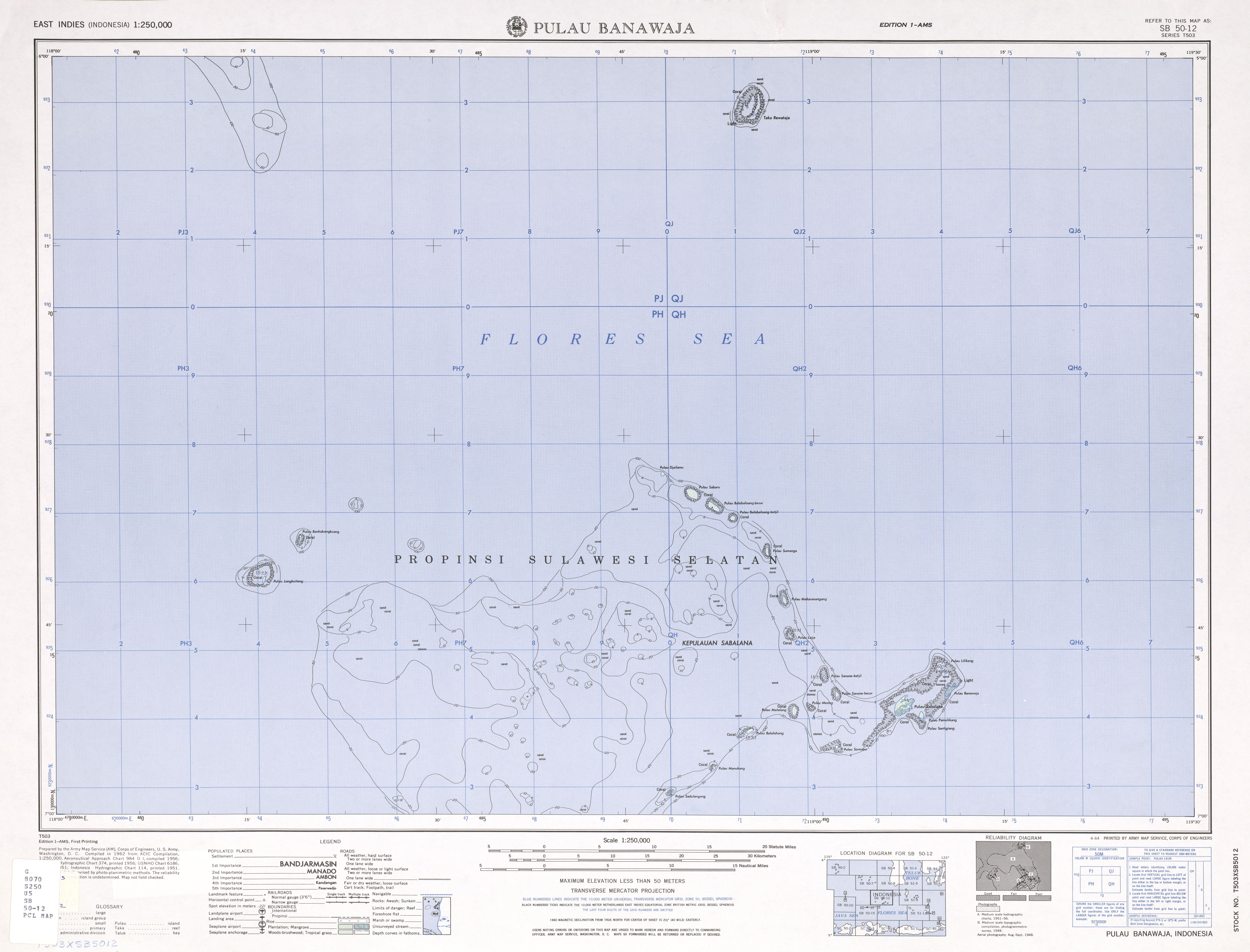
Sabalana Islands
The Sabalana Islands (Kepulauan Sabalana) are an Atoll in the Flores Sea in Indonesia, lying just north of the Lesser Sunda Islands, closer to Sumbawa than Sulawesi. They are west of Tanahjampea Island and north-east of the Tengah Islands (Central Islands). Administratively, the atoll belongs to the province of South Sulawesi. The total area, including the large lagoon, is 2694 km², making Sabalana one of the largest atolls by total area. The land area of the largest individual island, Pulau Sabalana, measures about 7 km², followed by Pulau Banawaja with 3 km² and Pulau Sabaru with 1.4 km².
The individual islets are listed, clockwise from the northernmost to the southernmost (the western rim of the atoll is free of islets):
- Pulau Djailamu
- Pulau Sabaru
- Pulau Balobaloang-besar
- Pulau Balobaloang-ketjil
- Pulau Sumanga
- Pulau Makaranangang
- Pulau Laija
- Pulau Sanane-ketjil
- Pulau Sanane-besar
- Pulau Sabalana
- Pulau Banawaja (easternmost)
- Pulau Pamolikang
- Pulau Santigiang
- Pulau Soroabu
- Pulau Meong
- Pulau Matalang
- Pulau Balalohong
- Pulau Manukang
- Pulau Sadulangang
- Pulau Sarege
External links
- 1:250,000 topographic map (northern part)
- 1:250,000 topographic map (southern part)
- 1:1000,000 topographic map (International Map of the World)
This article is issued from Wikipedia. The text is licensed under Creative Commons - Attribution - Sharealike. Additional terms may apply for the media files.