Royal Military Canal Path
The Royal Military Canal Path is a long-distance path in England, mainly following the Royal Military Canal. Its end points are Seabrook, Kent (51.0720°N 1.1221°E), and Pett Level, East Sussex (50.8887°N 0.6840°E), and it runs for 27 miles (43 km). It is a canal-side path and fringes the northern edge of Romney Marsh. The canal is an early-19th-century defence against a possible invasion by Napoleon, and it is a Scheduled Ancient Monument and a SSSI. Links are made with the Saxon Shore Way at Appledore and West Hythe.[1][2]
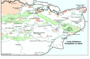
The Royal Military Canal Path, and the other long-distance footpaths in Kent
See also
References
- "Royal Military Canal Path". Long Distance Walkers Association. Retrieved 25 January 2012.
- "Walking". Royal Military Canal. Retrieved 25 January 2012.
This article is issued from Wikipedia. The text is licensed under Creative Commons - Attribution - Sharealike. Additional terms may apply for the media files.