Rock Harbor (Michigan)
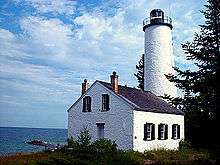
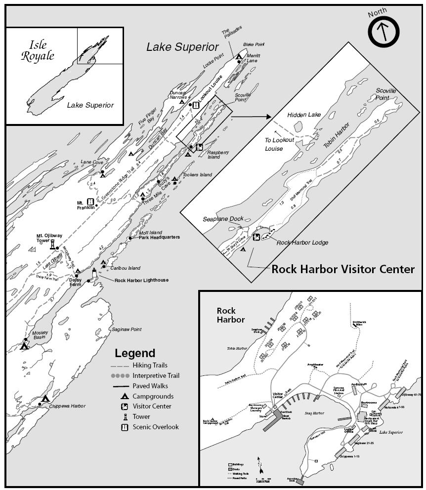
Rock Harbor is the main access point for visitors landing on Isle Royale in northern Lake Superior. It sits 4 miles from the northeastern end of the forty-five mile long island, the whole of which is protected as Isle Royale National Park. Two structures in Rock Harbor -- the Rock Harbor Light and the Edisen Fishery -- are listed on the National Register of Historic Places.
The Rock Harbor name is properly applied to the eleven-mile long inlet from Moskey Basin to Scoville Point along the southern shore of the easterly part of Isle Royale.[1] This inlet is screened from the open waters of Lake Superior by a number of offshore islands, including Mott Island, the site of the Park headquarters.[2]
Travel to Rock Harbor from the Upper Peninsula of Michigan is by the Ranger III park service ferry, operating from Houghton, Michigan,[3] the Isle Royale Queen IV out of Copper Harbor, Michigan,[4] and seaplane service.[5] The Voyageur II operates out of Grand Portage, Minnesota; it circumnavigates the island with stops at Windigo Ranger Station in Washington Harbor on the west end of the island and other points along the shore.[6]
The ferry boats land at Snug Harbor, which also has berths for private watercraft, a campground, the visitor center, and a lodge that predates the national park.[2][7]
Rock Harbor is the eastern end and terminus of the Greenstone Ridge Trail.
References
- Park (PDF) (Map). National Park Service. Archived from the original (PDF) on 2007-08-13. Retrieved 2007-12-11.
- Rock Harbor Area (Map). National Park Service. Retrieved 2001-12-01.
- "Ranger III". National Park Service. Retrieved 2007-12-01.
- "The Isle Royale Line". Retrieved 2007-12-01.
- "Royale Air Service". Archived from the original on 2009-03-01. Retrieved 2007-12-01.
- "Schedules". The North Shore Connection to Isle Royal National Park. Grand Portage-Isle Royale Transportation Line. Retrieved 2007-12-01.; Designated stops, Isle Royale (Map). Grand Portage-Isle Royale Transportation Line. Retrieved 2007-12-01.
- "Rock Harbor Area". Hunt's Guide to Michigan's Upper Peninsula. Retrieved 2007-12-01.