Richenpong
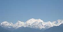
Rinchenpong is a town in West Sikkim, India. It is situated in West Sikkim, about 40 km west of Gangtok, 10 km due south of Gyalshing, close to the village of Kaluk. It sits at an altitude of 5576 feet (1,700m). It is known for the Rigsum Monastery and trekking routes.
Richenpong Rinchenpong | |
|---|---|
Town | |
 Richenpong Location in Sikkim, India  Richenpong Richenpong (India) | |
| Coordinates: 27.242192°N 88.270916°E | |
| Country | |
| State | Sikkim |
| District | West Sikkim |
| Government | |
| • Type | Democratic |
| • Body | SDF |
| Languages | |
| • Official | Nepali, Bhutia, Lepcha, Limbu, Newari, Rai, Gurung, Mangar, Sherpa, Tamang and Sunwar |
| Time zone | UTC+5:30 (IST) |
| Vehicle registration | SK |
Near the town is the site of a historical battle between the forces of the then Chogyal (King) of Sikkim and the invading British forces. The Lepcha tribesmen used a concoction of unidentified herbs to poison the only water source, a lake (local term : pokhri). As a result, more than half of the British forces were killed, which stopped the British invasion and resulted in an accord. The lake remains poisoned even to this day and is known as bikh-pokhri locally (poisoned lake).
The region's local language is Nepali, Lepcha, Bhutia, Hindi and English. The area's height is 5576 ft., and postcode is 737111.