Resting Spring Range
The Resting Spring Range is found in the eastern Mojave Desert of California near the Nevada state line in the United States. The range lies in a generally north-south direction to the west of the Nopah Range and southeast of the Amargosa Range and Greenwater Range.
| Resting Spring Range | |
|---|---|
 West side of the Resting Spring Range seen from Pahrump, Nevada | |
| Highest point | |
| Elevation | 1,194 m (3,917 ft) |
| Geography | |
 location of Resting Spring Range in California [1] | |
| Country | United States |
| State | California |
| District | Inyo County |
| Range coordinates | 36°4′59.859″N 116°14′3.106″W |
| Topo map | USGS Twelvemile Spring |
The mountains, in Inyo County on the California side, lie between Highway 178 and Highway 127.

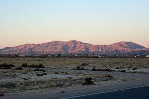
East side of the Resting Spring Range seen from the Mojave Desert.
References
- "Resting Spring Range". Geographic Names Information System. United States Geological Survey. Retrieved 2009-05-04.
- Allan, Stuart (2005). California Road and Recreation Atlas. Benchmark Maps. p. 89. ISBN 0-929591-80-1.
This article is issued from Wikipedia. The text is licensed under Creative Commons - Attribution - Sharealike. Additional terms may apply for the media files.