Raufarhöfn
Raufarhöfn is a village located on the northeastern tip of the Melrakkaslétta peninsula in Iceland.
Raufarhöfn | |
|---|---|
Village | |
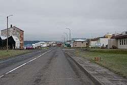 Raufarhöfn street view | |
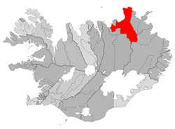 Location of the Municipality of Norðurþing | |
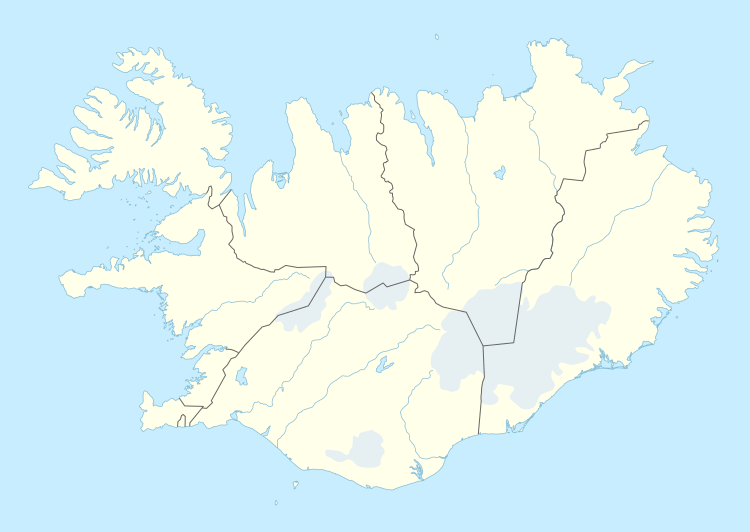 Raufarhöfn Location of Raufarhöfn in Iceland | |
| Coordinates: 66°27′15″N 15°57′00″W | |
| Country | |
| Constituency[1] | Northeast Constituency |
| Region[2] | Northeastern Region |
| Municipality | Norðurþing |
| Population (2019) | |
| • Total | 188 |
| Time zone | UTC+0 (GMT) |
History
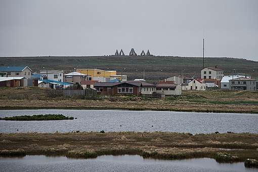
At one point in time, this small village was home to largest export harbor in Iceland. In the forties and fifties, the Herring frenzy dominated the Icelandic economy and Raufarhöfn was an important place in that economic chain. But after the herring disappeared the effect was devastating for the village. This is the reason for the old and interesting factory buildings.[3] The village is the site of a modern monument called the "Arctic Henge" which is aligned to the heavens and is inspired by the mythical world of the Eddic poem Völuspá (Prophecy of the Seeress).[4] As of 2019, it has 188[5] inhabitants. It was a major fish processing station during the large herring catches in the mid 20th century.[6]
Climate
The climate is tundra (Koppen: ET). As the northernmost community of mainland Iceland, Raufarhöfn is also the coldest with an annual average of 2.0 °C.[7]
| Climate data for Raufarhöfn (1961–1990) | |||||||||||||
|---|---|---|---|---|---|---|---|---|---|---|---|---|---|
| Month | Jan | Feb | Mar | Apr | May | Jun | Jul | Aug | Sep | Oct | Nov | Dec | Year |
| Record high °C (°F) | 10.3 (50.5) |
11.0 (51.8) |
12.7 (54.9) |
17.0 (62.6) |
20.8 (69.4) |
24.0 (75.2) |
23.0 (73.4) |
24.7 (76.5) |
21.7 (71.1) |
17.2 (63.0) |
14.8 (58.6) |
10.6 (51.1) |
24.7 (76.5) |
| Average high °C (°F) | 0.4 (32.7) |
0.8 (33.4) |
0.6 (33.1) |
2.8 (37.0) |
5.8 (42.4) |
9.3 (48.7) |
10.9 (51.6) |
10.8 (51.4) |
8.0 (46.4) |
5.1 (41.2) |
1.9 (35.4) |
0.8 (33.4) |
4.8 (40.6) |
| Daily mean °C (°F) | −2.2 (28.0) |
−1.9 (28.6) |
−2.2 (28.0) |
−0.2 (31.6) |
2.9 (37.2) |
6.4 (43.5) |
8.0 (46.4) |
8.0 (46.4) |
5.3 (41.5) |
2.6 (36.7) |
−0.6 (30.9) |
−2.0 (28.4) |
2.0 (35.6) |
| Average low °C (°F) | −5.0 (23.0) |
−4.6 (23.7) |
−4.9 (23.2) |
−2.8 (27.0) |
0.5 (32.9) |
4.0 (39.2) |
5.7 (42.3) |
5.7 (42.3) |
2.8 (37.0) |
0.2 (32.4) |
−3.3 (26.1) |
−4.9 (23.2) |
−0.6 (30.9) |
| Record low °C (°F) | −21.5 (−6.7) |
−21.2 (−6.2) |
−24.6 (−12.3) |
−21.8 (−7.2) |
−16.0 (3.2) |
−3.7 (25.3) |
−2.3 (27.9) |
−2.2 (28.0) |
−6.0 (21.2) |
−11.2 (11.8) |
−17.9 (−0.2) |
−17.9 (−0.2) |
−24.6 (−12.3) |
| Average precipitation mm (inches) | 76 (3.0) |
57 (2.2) |
66 (2.6) |
47 (1.9) |
28 (1.1) |
39 (1.5) |
48 (1.9) |
58 (2.3) |
73 (2.9) |
86 (3.4) |
80 (3.1) |
76.5 (3.01) |
733 (28.9) |
| Mean monthly sunshine hours | 5.2 | 25.7 | 47.5 | 75.7 | 108.2 | 113.5 | 96.2 | 90.2 | 57.7 | 31.6 | 9.5 | 0.1 | 661.1 |
| Source: Vedur.is[7] | |||||||||||||
See also
References
- Political division
- Mainly statistical division
- "Hit Iceland information page about Iceland"
- Nemiroff, R.; Bonnell, J., eds. (30 April 2012). "Aurora Over Raufarhöfn". Astronomy Picture of the Day. NASA. Retrieved 30 April 2012.
- The population of zipcode 675 sourced from https://www.statice.is/statistics/population/inhabitants/municipalities-and-urban-nuclei/ in March 2019.
- "Hit Iceland information page about Iceland"
- "Climate data for Raufarhöfn". vedur.is.