Rahir Point
Rahir Point (65°4′S 63°14′W) is a point marking the northeast end of a small peninsula which extends into Flandres Bay just north of Thomson Cove, on the northeast coast of Kiev Peninsula, Graham Land. First charted by the Belgian Antarctic Expedition under Gerlache, 1897–99, and named "Cap Rahir," probably for Maurice Rahir, Belgian geographer and member of the Belgian Royal Geographical Society.
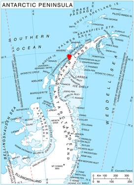
Location of Kiev Peninsula in Graham Land, Antarctic Peninsula.
References
![]()
![]()
This article is issued from Wikipedia. The text is licensed under Creative Commons - Attribution - Sharealike. Additional terms may apply for the media files.