R261 road (Ireland)
The R261 road is a regional road in Ireland. It is a loop road from the N56 road on the Loughrea Peninsula in County Donegal.[2][3] The road forms part of the Wild Atlantic Way.[4]
| ||||
|---|---|---|---|---|
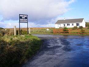 Junction near Ardara | ||||
| Route information | ||||
| Length | 13.5 km[1][2] (8.4 mi) | |||
| Major junctions | ||||
| From | ||||
| To | ||||
| Road network | ||||
| ||||

The R261 travels west from the N56 at Maas to a minor road leading to the beach villages of Narin[3] and Portnoo. From this junction the road travels south, passing the megalithic tombs of Kilclooney More, to rejoin the N56 at Ardara. The R261 is 13.5 km (8.4 mi) long.[1]
References
- Google (20 Apr 2016). "R261 to R261" (Map). Google Maps. Google. Retrieved 20 Apr 2016.
- "S.I. No. 54/2012 – Roads Act 1993 (Classification of Regional Roads) Order 2012". Government of Ireland. 28 Feb 2012. Retrieved 20 Apr 2016.
- Davenport, Fionn; Dixon, Belinda; Le Nevez, Catherine; O'Carroll, Oda (Feb 2013). Lonely Planet Ireland's Best Trips. Lonely Planet. p. 326. ISBN 978-1-7432-1779-5.
- "Wild Atlantic Way: Explore The Route". Fáilte Ireland. Retrieved 20 Apr 2016.
This article is issued from Wikipedia. The text is licensed under Creative Commons - Attribution - Sharealike. Additional terms may apply for the media files.