Pumiri
Pumiri is a 4,862-metre-high (15,951 ft) volcano in the Andes that rises 1,062 metres (3,484 ft) above the surrounding terrain.[1] The volcano is located in the Oruro Department, Sabaya Province, northwest of the Salar de Coipasa.[2]
| Pumiri | |
|---|---|
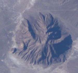 Pumiri as seen from space | |
| Highest point | |
| Elevation | 4,862 m (15,951 ft) |
| Coordinates | 19°00′00″S 68°26′00″W [1] |
| Geography | |
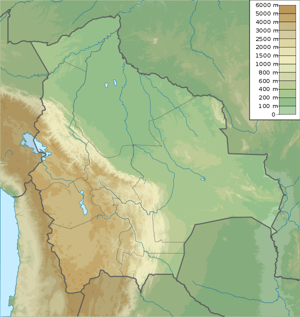 Pumiri Location in Bolivia | |
| Location | Bolivia, Oruro Department, Sabaya Province |
| Parent range | Andes |
The volcano is formed from two volcanic cones. The younger of which may be of Holocene age and is constructed in the middle of a caldera marked by a semilunar shape.[3]:141 Thanks to heavy erosion, lavas and eruption products are mostly found in peripheral parts of the edifice, while in the central area a deep-grounded crystalline core is exposed.[4]:150 A breach 3.5 kilometres (2.2 mi) wide and 5.5 kilometres (3.4 mi) long with an azimuth of 139° lies in the volcano, whose summit has a maximum slope of 25°.[1] The volcano forms a lineament with Saxani and Isluga.[5]
The creeks named Qhamiña (Camiña) and on the western side Waywasi (Guayhuase) originate on the volcano.[6]:101 Sulfur deposits on the volcano were exploited by indigenous people.[7]:63
References
- Francis, P. W.; Wells, G. L. (1988). "Landsat Thematic Mapper observations of debris avalanche deposits in the Central Andes". Bulletin of Volcanology. 50 (4): 261. doi:10.1007/BF01047488. ISSN 0258-8900.
- Jiménez, J.A.; Cano, M.J. (2008). "Taxonomic assessment of Didymodon pruinosus (Mitt.) R.H. Zander (Bryophyta, Pottiaceae) a poorly known South American taxon". Nova Hedwigia. 87 (1): 146. doi:10.1127/0029-5035/2008/0087-0145. ISSN 0029-5035.
- Geologisches Jahrbuch: Allgemeine und regionale Geologie Bundesrepublik Deutschland und Nachbargebiete, Tektonik, Stratigraphie, Paläontologie (in German). E. Schweizerbart'sche Verlagsbuchhandlung in Kommission. 1976.
- Archives de minéralogie (in French). 1934.
- Avila-Salinas, Waldo (1991). "Petrologic and tectonic evolution of the Cenozoic volcanism in the Bolivian western Andes". 265: 248. doi:10.1130/SPE265-p245. ISSN 0072-1077. Cite journal requires
|journal=(help) - Guillermo Eduardo Billinghurst (1893). La irrigación en Tarapacá (in Spanish). Imprenta y Librería Ercilla.
- Guillermo Eduardo Billinghurst (1886). Estudio sobre la geografía de Tarapacá: (páginas de un libro) (in Spanish). Imprenta de "El Progreso".