Prince Charles Mountains
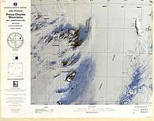
The Prince Charles Mountains are a major group of mountains in Mac. Robertson Land in Antarctica, including the Athos Range, the Porthos Range, and the Aramis Range. The highest peak is Mount Menzies (3228 m). Other prominent peaks are Mount Izabelle and Mount Stinear (1950 m). These mountains together with other scattered peaks form an arc about 260 miles long, extending from the vicinity of Mount Starlight in the north to Goodspeed Nunataks in the south.[1]
| Prince Charles Mountains | |
|---|---|
 Prince Charles Mountains | |
| Highest point | |
| Peak | Mount Menzies |
| Elevation | 3,228 m (10,591 ft) |
These mountains were first observed and photographed from a distance by airmen of USN Operation Highjump, 1946-47. They were examined by several ANARE (Australian National Antarctic Research Expeditions) parties and mapped in the years 1954-61.[1] They have been found to contain large deposits of iron ore.[2] They were named by ANCA in 1956 for Prince Charles, the eldest son and heir apparent of Queen Elizabeth II.[1]
List of key mountains
- Mount Afflick (70°46′S 66°11′E) is a ridge-like mountain about 3 miles (5 km) west of Mount Bunt in the Aramis Range. Plotted from Australian National Antarctic Research Expeditions air photos taken in 1960. Named by ANCA for G.M. Afflick, weather observer at Mawson Station in 1965.
- Mount Bayliss (73°32′S 62°44′E) is a relatively low mountain, extending 9 nautical miles (17 km) in an east-west direction, standing 6 nautical miles (11 km) east of Mount Menzies. Observed from ANARE aircraft in 1957 and seen in the same year by an ANARE ground party under K.B. Mather. Named by ANCA for E.P. Bayliss, Australian cartographer, who drew the map of Antarctica published in 1939 by the Property and Survey Branch, Dept. of Interior, Canberra.[3]
- Mount Bunt (70°46′S 66°22′E) is a sharp, conical peak, 2,315 metres (7,600 ft) high, which appears slightly truncated when viewed from the northwest, situated at the southwest end of a group of low peaks about 7 nautical miles (13 km) southeast of Mount Hollingshead in the Aramis Range. It was sighted in January 1957 by the Australian National Antarctic Research Expeditions southern party led by W.G. Bewsher, and named by the Antarctic Names Committee of Australia for J.S. Bunt, a biologist at Mawson Station in 1956.[1]
- Mount Cartledge (70°17′S 65°43′E) is a mountain just east of Mount Albion in the Athos Range. It was plotted from Australian National Antarctic Research Expeditions air photos of 1965, and named by the Antarctic Names Committee of Australia for W.J. Cartledge, plumber at Wilkes Station in 1962, and carpenter at Mawson Station in 1966.
- Mount Gibson (71°20′S 66°20′E) is a small mountain about 2.5 nautical miles (4.6 km) west of Mount Cameron and 3 nautical miles (6 km) south of Schmitter Peak. Plotted from ANARE air photos taken in 1956 and 1960. Named by ANCA after P.R. Gibson, plumber at Wilkes Station in 1965.[4]
- Mount Izabelle (72°10′S 66°30′E) is a bare rock mountain standing 12 miles (19 km) southwest of the Shaw Massif. Discovered from an ANARE Beaver aircraft on November 28, 1956, while engaged in aerial photography. Named by ANCA for B. Izabelle, weather observer at Mawson Station in 1957.[5]
- Mount Meredith (71°12′S 67°45′E) is a fairly massive, almost flat-topped mountain standing 10 nautical miles (19 km) north of Fisher Massif. It was photographed from Australian National Antarctic Research Expeditions aircraft in 1956 and 1957, and was named by the Antarctic Names Committee of Australia for Sergeant N. Meredith, RAAF, an engine fitter at Mawson Station in 1957.[6]
- Mount Rymill (73°03′S 65°50′E) is a fairly massive mountain with an undulating surface marked by extensive formation of stone polygons, standing 6 mi W of Mount Stinear. Photographed from the air by ANARE, 1956-58. Named by ANCA for John Riddoch Rymill, leader of the British Graham Land Expedition, 1934-37.[7]
- Schmitter Peak (71°16′S 66°21′E) is a small mountain peak about 3 mi SW of Mount Woinarski. Plotted from ANARE air photos taken in 1956 and 1960. Named by ANCA for U. Schmitter, cook at Davis Station in 1964.[8]
- Shaw Massif (72°01′S 66°51′E) is a fairly flat-topped rock massif (1,355 m) on the west margin of Lambert Glacier standing 20 km (12 mi) south of Mount Willing. Sighted in November 1956 from an ANARE aircraft. Named by ANCA for Bernard Shaw, radio supervisor at Mawson Station in 1957.[9]
- Simon Ridge (71°03′S 65°30′E) is an arc-shaped rock ridge about 13 km (8 mi) southeast of Husky Massif. Plotted from ANARE air photos taken in 1960. Named for M.J. Simon, radio officer at Wilkes Station in 1962.[10]
- Mount Stinear (73°04′S 66°24′E) is a prominent rock peak on a large massif rising to 1,950 metres (6,398 ft), standing just east of Mount Rymill at the junction of Fisher Glacier and Lambert Glacier. It was mapped from air photos taken by the RAAF Antarctic Flight in 1956, and first visited in October 1957 by an ANARE party led by Bruce H. Stinear, geologist at Mawson Station, for whom it is named.[11]
Features
Aramis Range
Other features in the Aramis Range:
Athos Range
- Bradley Ridge
- Dawson Nunatak
- Harriss Ridge
- Hunt Nunataks
- Kotterer Peaks
- Leah Ridge
- McKenzie Peak
- Miller Ridge
- Mount Béchervaise
- Mount Bool
- Mount Cardell
- Mount Cartledge
- Mount Dart
- Mount Dovers
- Mount Dwyer
- Mount Lacey
- Mount Mercer
- Mount Moonie
- Mount Peter
- Mount Seedsman
- Mount Stalker
- Smith Nunatak
- Svensson Ridge
- Weasel Gap
- Whelan Nunatak
- Wignall Nunataks
Porthos Range
- Charybdis Glacier
- Corry Massif
- Crohn Massif
- Cutcliffe Peak
- Hulcombe Ridge
- Martin Massif
- Morgan Ridge
- Mount Canham
- Mount Creighton
- Mount Eather
- Mount Gaston
- Mount Gavaghan
- Mount Kerr
- Mount Kirkby
- Mount Leckie
- Mount Lied
- Mount McCarthy
- Mount Mervyn
- Mount Pollard
- Mount Small
- Mount Tarr
- Mount Ware
- O'Shea Peak
- Thomas Nunataks
- Webster Peaks
- Whitworth Ridge
- Wignall Peak
- Wignall
Other features
- Allison Ridge
- Armonini Nunatak
- Baggott Ridge
- Bain Crags
- Bainmedart Cove
- Baldwin Nunatak
- Baseline Nunataks
- Beaver Lake (Antarctica)
- Bennett Escarpment
- Binders Nunataks
- Bond Ridge
- Bosse Nunatak
- Brocklehurst Ridge
- Carpenter Nunatak
- Carter Peak
- Chapman Nunatak
- Clague Ridge
- Collins Glacier
- Cumpston Massif
- Davern Nunatak
- Dohle Nunatak
- Edwards Nunatak
- Edwards Pillar
- Ellyard Nunatak
- Ely Nunatak
- Fisher Massif
- Flagstone Bench
- Foale Nunatak
- Fossil Wood Point
- Francey Hill
- Geysen Glacier
- Glossopteris Gully
- Goodall Ridge
- Goodspeed Nunataks
- Gorman Crags
- Grainger Valley
- Hall Nunataks
- Hudson Nunatak
- Keyser Ridge
- Kilfoyle Nunataks
- Lensink Peak
- Machin Nunatak
- Mayman Nunatak
- McLean Ridge
- Mellor Glacier
- Moore Pyramid
- Mount Bakker
- Mount Beck
- Mount Bensley
- Mount Bewsher
- Mount Bloomfield
- Mount Brown-Cooper
- Mount Butterworth
- Mount Cresswell
- Mount Dowie
- Mount Dummett
- Mount Forecast
- Mount Gibson
- Mount Gleeson
- Mount Grimsley
- Mount Hayne
- Mount Hicks
- Mount Hollingshead
- Mount Johnston
- Mount Lanyon
- Mount Lugg
- Mount Mather
- Mount Mather
- Mount McCarthy
- Mount McCauley
- Mount McMahon
- Mount Meredith
- Mount Newton
- Mount Ormay
- Mount Reu
- Mount Rubin
- Mount Ruker
- Mount Scherger
- Mount Seddon
- Mount Sundberg
- Mount Thomas
- Mount Trott
- Mount Turnbull
- Mount Willing
- Mount Wishart
- Mount Woinarski
- Murray Dome
- Nemesis Glacier
- Nilsson Rocks
- O'Keefe Hill
- O'Leary Ridges
- Pagodroma Gorge
- Pardoe Peak
- Patrick Point
- Sandilands Nunatak
- Saxton Ridge
- Scanlan Peak
- Scylla Glacier
- Seavers Nunataks
- Sullivan Nunataks
- Taylor Platform
- Thomson Massif
- Vrana Peak
- Walker Valley
- Wall Peak
- Webster Peaks
- White Massif
Notes
- "Prince Charles Mountains". Geographic Names Information System. United States Geological Survey. Retrieved 2005-09-28.
- Antarctica: An Encyclopedia from Abbot Ice Shelf to Zooplankton, Firefly, 2002. ISBN 1-55297-590-8.
- "Mount Bayliss". Geographic Names Information System. United States Geological Survey. Retrieved 2010-09-23.
- "Mount Gibson". Geographic Names Information System. United States Geological Survey. Retrieved 2009-02-18.
- "Mount Izabelle". Geographic Names Information System. United States Geological Survey. Retrieved 2008-03-20.
- "Mount Meredith". Geographic Names Information System. United States Geological Survey. Retrieved 2013-09-19.
- "Mount Rymill". Geographic Names Information System. United States Geological Survey. Retrieved 2010-10-17.
- "Schmitter Peak". Geographic Names Information System. United States Geological Survey. Retrieved 2010-10-17.
- "Shaw Massif". Geographic Names Information System. United States Geological Survey. Retrieved 2008-01-02.
- "Simon Ridge". Geographic Names Information System. United States Geological Survey. Retrieved 2008-03-16.
- "Mount Stinear". Geographic Names Information System. United States Geological Survey. Retrieved 2005-09-28.
External links
![]()