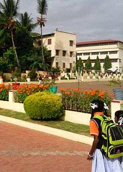
Periyapatna
Periyapatna is located at 12°20′N 76°06′E / 12.34°N 76.1°E / 12.34; 76.1[1]. It has an average elevation of 849 metres (2769 feet).
Periyapatna | |
|---|---|
Town | |
 | |
 Periyapatna Location in Karnataka, India | |
| Coordinates: 12.33649°N 76.07918°E | |
| Country | |
| State | Karnataka |
| District | Mysore |
| Area | |
| • Total | 2 km2 (0.8 sq mi) |
| Elevation | 849 m (2,785 ft) |
| Population (2001)(estimated) | |
| • Total | 10,000 |
| • Density | 5,000/km2 (13,000/sq mi) |
| Languages | |
| • Official | Kannada |
| Time zone | UTC+5:30 (IST) |
| PIN | 571107 |
| Telephone code | 08223 |
| Vehicle registration | KA-45 |
| Nearest cities | Mysore and Kushalanagara |
| mysore-kodagu | Periyapattana |
| Climate | Tropical wet and dry (Köppen) |
Location
Periyapatna is located at 12.34°N 76.1°E.[1] It has an average elevation of 849 metres (2769 feet). The town is situated on Mangalore-Mysore-Bangalore highway (NH275) at a distance of 70 km from Mysore.
Demographics
Piriyapatna had a population of 14,922. Males constitute 51% of the population and females 49%. Piriyapatna has an average literacy rate of 67%, higher than the national average of 59.5%: male literacy is 72%, and female literacy is 61%. In Piriyapatna, 11% of the population is under 6 years of age.
Vokkaliga Gowda community forms the highest population of the Taluk and majorly are tobacco cultivators. Also it is the homeland for Majority of Minor Tribal group Beda Nayakas(ST-Hunting tribal groups..also called as Valmiki Nayakas) vowing to thick Malanad forest around and Hunting being their occupation. As of 2001 India census,[2]
References
- Falling Rain Genomics, Inc – Piriyapatna
- "Census of India 2001: Data from the 2001 Census, including cities, villages and towns (Provisional)". Census Commission of India. Archived from the original on 16 June 2004. Retrieved 1 November 2008.