Pingbilly, New South Wales
Pingbilly, New South Wales is a remote rural locality and civil parish of Evelyn County, New South Wales[1] in far northwest New South Wales.[2]
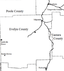
Evelyn County map.
The geography of the Parish is mostly the flat, arid landscape of the Channel Country. The parish has a Köppen climate classification of BWh (Hot desert).[3] The nearest town is Tibooburra to the north, which is on the Silver City Highway and lies south of the Sturt National Park.[4]
The Parish is located at 30°07′11″S 141°34′06″E in the arid semi desert midway between Packsaddle, New South Wales and Milparinka, New South Wales.
References
- "Evelyn County". Geographical Names Register (GNR) of NSW. Geographical Names Board of New South Wales.

- Map of the County of Evelyn : Western Division.
- Peel, M. C.; Finlayson, B. L.; McMahon, T. A. (2007). "Updated world map of the Köppen–Geiger climate classification". Hydrol. Earth Syst. Sci. 11: 1633–1644. doi:10.5194/hess-11-1633-2007. ISSN 1027-5606. (direct: Final Revised Paper)
- Olive Downs campground.
This article is issued from Wikipedia. The text is licensed under Creative Commons - Attribution - Sharealike. Additional terms may apply for the media files.