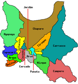
Pichaqani (Quillacollo-Tapacarí)
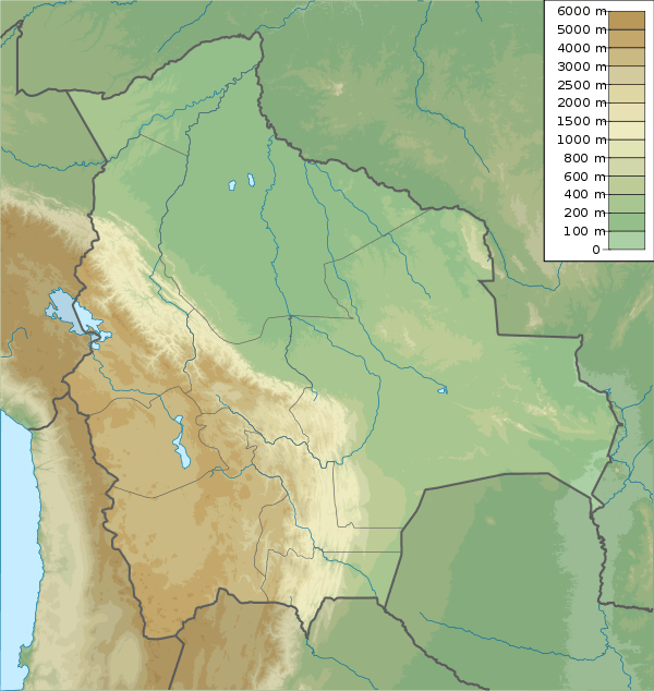
Pichaqani (Aymara pichaqa, phichaqa, piqacha a big needle,[2] -ni a suffix, "the one with a big needle", also spelled Pichacani) is a 3,799-metre-high (12,464 ft) mountain in the Bolivian Andes. It is located in the Cochabamba Department, at the border of the Quillacollo Province, Sipe Sipe Municipality, and the Tapacarí Province. Pichaqani lies southeast of Yuraq Q'asa.[1][3]
| Pichaqani | |
|---|---|
 Pichaqani Location within Bolivia | |
| Highest point | |
| Elevation | 3,799 m (12,464 ft) [1] |
| Coordinates | 17°28′21″S 66°28′28″W |
| Geography | |
| Location | Bolivia, Cochabamba Department |
| Parent range | Andes |
References
- Bolivia 1:50,000 Quillacollo 6341-IV
- Radio San Gabriel, "Instituto Radiofonico de Promoción Aymara" (IRPA) 1993, Republicado por Instituto de las Lenguas y Literaturas Andinas-Amazónicas (ILLLA-A) 2011, Transcripción del Vocabulario de la Lengua Aymara, P. Ludovico Bertonio 1612 (Spanish-Aymara-Aymara-Spanish dictionary) see: Piqacha, pichaqa and Phichaqa
- "Sipe Sipe". INE, Bolivia. Archived from the original on March 29, 2016. Retrieved March 28, 2016.
This article is issued from Wikipedia. The text is licensed under Creative Commons - Attribution - Sharealike. Additional terms may apply for the media files.