Penycloddiau
Penycloddiau is a hill in Flintshire, Wales, and one of five Marilyns in the Clwydian Range.
| Penycloddiau | |
|---|---|
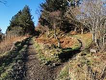
 A view of the outer defence wall at Penycloddiau hill fort | |
| Highest point | |
| Elevation | 440 m (1,440 ft) [1] |
| Prominence | 156 m (512 ft) |
| Parent peak | Moel Famau |
| Listing | Marilyn |
| Naming | |
| English translation | hill of the trenches |
| Language of name | Welsh |
| Pronunciation | Welsh: [pɛnəˈklɔðjai] |
| Geography | |
| Location | Flintshire, Wales |
| Parent range | Clwydian Range |
| OS grid | SJ127678[1] |
| Topo map | OS Landranger 116[1] |
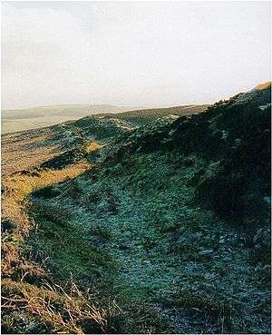
The hill, like Foel Fenlli and Moel Arthur to the south, has an Iron Age hillfort at its summit.[2] It covers 26 hectares (64 acres) making it one of the largest hillforts in Wales.[2] In 2017, excavations by the Clywdian Range Archaeology Group (CRAG) unearthed a significant number of 4,000-year-old stone tools from the Bronze Age, the discovery indicates human activity occurred much earlier than first thought in the area.[3]
Penycloddiau is crossed by the Offa's Dyke Path and the Clwydian Way, two long distance footpaths that traverse the hills in this area. A free car park exists at the bwlch between Penycloddiau and Moel Arthur, where two footpaths lead to the summit. [4]
See also
References
- Alan Dawson (1992). Relative Hills of Britain. Cicerone Series. Cicerone Press Limited. p. 125. ISBN 978-1-85284-068-6.
- John Davies; Nigel Jenkins; Menna Baines, eds. (2008). The Welsh Academy encyclopaedia of Wales. University of Wales Press. pp. 151, 981. ISBN 978-0-7083-1953-6. Missing or empty
|title=(help) - "Bronze Age tools unearthed in Clwydian range hillforts dig". BBC NEWS. 7 September 2017.
- "Penycloddiau". Sustainable Days Out. Retrieved 2020-01-19.
Further reading
- Ian Brown; Mick Sharp & Jean Williamson (2004). "Penycloddiau Iron Age hillfort". Discovering a Welsh landscape: archaeology in the Clwydian range. Landscapes of Britain. 4. Windgather. pp. 75–76.
- "Penycloddiau Hillfort". Heather & Hillforts. Archived from the original on 2013-04-20. Retrieved 2010-08-31.
- "Penycloddiau Hillfort — Dig In Deeper". Heather & Hillforts.
- "Soldier's Stone, Penycloddiau hillfort". A History of the World. BBC.
- Christopher John Wright (1975). "Moel Arthur and Penycloddiau". A guide to Offa's Dyke path. Constable. pp. 321–323. ISBN 978-0-09-460330-1.
External links
| Wikimedia Commons has media related to Penycloddiau Hillfort. |