Patshull
Patshull is a former parish now in the civil parish of Pattingham and Patshull, South Staffordshire, 7 miles west of Wolverhampton and 7½ miles east of Bridgnorth. According to the 2011 census it had a population of 212.[1] The parish consisted of Patshull, Burnhill Green and, along its eastern boundary, Westbeech (old name Westbach). It formerly contained several farmhouses and small cottages,[2] but Burnhill Green is the main hamlet. In 1961 the civil parish had a population of 154.[3]
| Patshull | |
|---|---|
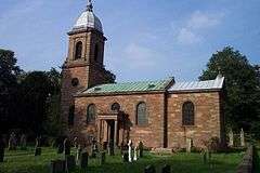 St. Mary's Church | |
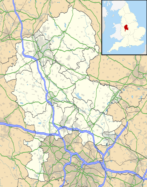 Patshull Location within Staffordshire | |
| Population | 212 (2011 Census)[1] |
| OS grid reference | SJ800006 |
| Civil parish |
|
| District | |
| Shire county | |
| Region | |
| Country | England |
| Sovereign state | United Kingdom |
| Post town | Wolverhampton |
| Postcode district | WV6 |
| Dialling code | 01902 |
| Police | Staffordshire |
| Fire | Staffordshire |
| Ambulance | West Midlands |
History
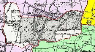
Mauve: parishes in ShropshireYellow: parish of Tettenhall Green: parish of Pattingham
Patshull, which was anciently called Peccleshala, occupies a salient of Staffordshire projecting into Shropshire. Area 1,850 acres. The parish contains Patshull Hall, which was set in a park of 341 acres.[4] The settlements are of small extent. The ground in the parish is level and generally fertile. It contains two lakes, called Patshull and Snowdon Pools,[5] the latter, which has a serpentine shape, adorning the front of the mansion of Patshull Hall.[4]
In 1986 the civil parishes of Patshull and Pattingham were amalgamated.[6] The new parish of Pattingham and Patshull was divided into two parish wards of Patshull and Pattingham, each consisting of the area of the identically named parish as previously constituted. Patshull was only allocated 2 parish councillors out of 11 in total.
The ecclesiastical parishes have likewise been amalgamated.
Patshull Church, dedicated to St. Mary, was built by Sir John Astley around 1743, and is situated in the park.[5][7]
The parish was in the South division of Seisdon Hundred.[5]
References
- Census of England and Wales 2011, Output Area:Pattingham and Patshull E00151089 www.ukcensusdata.com/pattingham-and-patshull-e00151089#sthash.GaBp4iig.dpbs retrieved Nov 2018
- A topographical history of Staffordshire, by William Pitt, pub J. Smith (Newcastle-under-Lyme), 1817; page 188
- "Population Statistics Patshull AP/CP through time". Vision of Britain. Retrieved 9 December 2018.
- History, Gazetteer and Directory of Staffordshire by William White, pub. Sheffield, 1834. Page 272
- National Gazetteer, Vol III, publ by Virtue & Co., London, 1868. Alphabetical article on Patshull.
- South Staffordshire Parishes Order 1986- Statutory Instrument 1986 No. 284
- Historic England, "Church of St Mary, Pattingham and Patshull (1039330)", National Heritage List for England, retrieved 4 February 2013