Paro, Bhutan
Paro (Dzongkha: སྤ་རོ་) is a town and seat of Paro District, in the Paro Valley of Bhutan.[1] It is a historic town with many sacred sites and historical buildings scattered throughout the area. It is also home to Paro Airport, Bhutan's sole international airport.
Paro  | |
|---|---|
.jpg) Aerial view of Paro | |
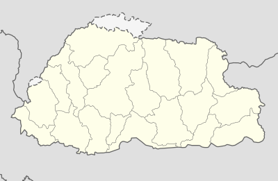 Paro Location in Bhutan | |
| Coordinates: 27°26′N 89°25′E | |
| Country | |
| District | Paro District |
| Gewog | Wangchang Gewog |
| Thromde | Paro |
| Elevation ་ at Paro Airport | 2,200 m (7,200 ft) |
| Population (2017) | |
| • Total | 11,448 |
| Time zone | UTC+6 (BTT) |
| Area code(s) | +975-8 |
| Climate | Cwb |
Architecture
The main street has many examples of traditionally decorated buildings.[2]
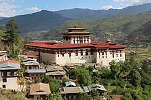
The Dungtse Lhakhang (a 15th-century temple) and the Ugyen Perli Palace are near the new bridge. Members of royal family lodge in the palace when in Paro.[2] Nearby is the old bridge and the Rinpung Dzong. Notable hotels include the Olathang Hotel built in an ornate style.[2]
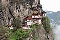
About 10 kilometres (6 miles) outside Paro is the famous Paro Taktsang (Tiger's Nest) Buddhist monastery and hermitage. Some Bhutanese believe that Padmasambhava (Guru Rinpoche) flew on the back of a tigress to this location from Tibet.[3] The trek to Tiger's Nest monastery takes about three hours one way. A scenic view of the town of Paro can be seen from the Tiger's Nest.[2] A 16-kilometre (10-mile) road passes up the valley to the ruins of another fortress-monastery, Drukyel Dzong, which was partly destroyed by fire in 1951.[2]
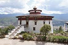
Paro is home to Bhutan's tallest building, the Ta-Dzhong, which is 22 meters (72 feet) high, and has 6 floors. It was completed in 1649.[4]
Airport
Paro Airport has been described as "the most difficult commercial airport in the world",[5] The airport has only one runway. Airplanes on approach pass by 5,500m Himalayan mountain peaks, and the 1,980m runway length presents a double challenge, due to the extremely high density altitude at the site. As a result, only a handful of airline pilots (8 as of December 2014) are certified to operate commercial aeroplanes there. About 30,000 persons arrive at the airport each year.
Gallery
 A street in Paro
 Shops in Paro
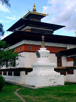
 View of Nyamai Zam above Paro Chhu
References
- National Geospatial Intelligence Agency
- "In The Kingdom Of Bhutan". Global Sapiens. 6 October 2002. Retrieved 11 July 2008.
- Pommaret, Francoise (2006). Bhutan Himalayan Mountains Kingdom (5th edition). Odyssey Books and Guides. pp. 136–7.
- https://www.emporis.com/statistics/tallest-buildings/country/100020/bhutan
- Paro Airport, atlas obscura (website), accessed 3 December 2014
External links
| Wikimedia Commons has media related to Paro town. |

| Authority control |
|
|---|