Parish of Warri
Warri Parish located at 29.035833°S 141.965278°E is a cadastral parish of Tongowoko County New South Wales.
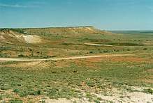
Landscape near Warri at Olive Downs.
The Parish of Warri is located on the Silver City Highway where it crosses the Queensland border. The Ctopography is flat and arid, typical of the Channel Country and the northern boundary of the Parish carries the Dingo Fence.
The parish has a Köppen climate classification of BWh (Hot desert)[1]. The County is barely inhabited with a population density of less than 1 person per 150km² and the landscape is a flat arid scrubland.
References
- Peel, M. C.; Finlayson, B. L.; McMahon, T. A. (2007). "Updated world map of the Köppen–Geiger climate classification". Hydrol. Earth Syst. Sci. 11: 1633–1644. doi:10.5194/hess-11-1633-2007. ISSN 1027-5606. (direct: Final Revised Paper)
This article is issued from Wikipedia. The text is licensed under Creative Commons - Attribution - Sharealike. Additional terms may apply for the media files.