Panguan Island
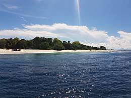
Panguan Island is an island in the municipality of Sitangkai, Tawi-Tawi. With an area of 0.06 square kilometres (0.023 sq mi). It is also known as Malamanok, coming from the Sama-Bajau dialect which means eat chicken as locals who travel to Sabah usually use this island as a stop-over to eat roasted chicken prior continuing their journey to Malaysia. It is the last island of the Sulu Archipelago nearest the Philippine-Malaysian border.[1]
| Native name: Malamanok | |
|---|---|
 Panguan Island | |
.svg.png) Panguan Island Location within the Philippines | |
| Geography | |
| Coordinates | 4°42′38″N 119°1′53″E |
| Archipelago | Sulu Archipelago |
| Adjacent bodies of water | Celebes Sea |
| Area | 0.06 km2 (0.023 sq mi)[1] |
| Administration | |
| Region | Bangsamoro Autonomous Region in Muslim Mindanao (BARMM) |
| Province | Tawi-Tawi |
| Municipality | Sitangkai |
The island has a newly constructed military barrack, a flagpole, and a small community of Badjao.[2]
History

Panguan Island was used as a hideout by the Abu Sayyaf terror group until it was liberated by the 10th Marines Battalion Landing Team (MBLT-10) of the Philippine Marine Corps[1] after the surrender of eleven high-ranking Abu Sayyaf leaders of Tawi-Tawi in April 2017.[3]
The Philippine flag was hoisted on the island last 29 April 2017[1] to signify control of the Philippine government.[4]
See also
References
- Malicdem, Ervin (13 June 2017). "Panguan Island, the most remote island paradise of the Philippines". Schadow1 Expeditions. Retrieved 25 June 2017.
- Severino, Howie (4 December 2017). "Somewhere out there is our unmarked border". GMA News. Retrieved 15 August 2018.
- Legaspi, Amita (12 April 2017). "11 Abu Sayyaf bandits surrender". GMA News. Retrieved 25 June 2017.
- Roxas, Joseph Tristan (1 May 2017). "PHL flag raised on Abu Sayyaf 'island paradise'". GMA News. Retrieved 25 June 2017.
External links
| Wikimedia Commons has media related to Panguan Island. |