OziExplorer
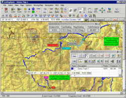
OziExplorer is raster navigation and mapping software for Windows. It is very popular among off-road drivers and adventure travelers as it allows to use and create custom maps for remote locations that are not fully covered by major map providers like Tele Atlas. That is why the software is also widely used on Post-Soviet states territory.
 | |
 | |
| Developer(s) | D & L Software Pty Ltd Australia |
|---|---|
| Stable release | 3.95.6f
/ February 2016 |
| Operating system | Microsoft Windows |
| Type | GPS navigation software |
| License | Shareware/Demo and Trial |
| Website | www.oziexplorer.com |
It supports editing, uploading and downloading of waypoints, routes and tracks to most Garmin, Magellan, Lowrance, Brunton and MLR GPS devices.[1]
OziExplorer provides support for Google Maps, Google Earth, TerraServer-USA, OpenStreetMap and Virtual Earth as well as creating your own maps.
Other versions
There are two more versions of OziExplorer:
- OziExplorer3D - 3D map viewer
- OziExplorerCE - Windows CE\Windows Mobile version of OziExplorer
- OziExplorer Android - Android version of OziExplorer
References
- "OziExplorer website". Retrieved 1 October 2009.
This article is issued from Wikipedia. The text is licensed under Creative Commons - Attribution - Sharealike. Additional terms may apply for the media files.