Ozhogina
The Ozhogina (Russian: Ожогина) is a tributary of the Kolyma in eastern Siberia. The river is 523 kilometres (325 mi) long. The area of its basin is 24,300 square kilometres (9,400 sq mi).[1]
| Ozhogina Yakut: Одьуогун | |
|---|---|
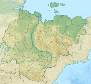 Location in the Sakha Republic, Russia | |
| Location | |
| Country | Russia |
| Physical characteristics | |
| Source | |
| • location | confluence of Sulakkan and Delkyu |
| • elevation | 109 m (358 ft) |
| Mouth | Kolyma |
• coordinates | 66°13′10″N 151°05′24″E |
• elevation | 21 m (69 ft) |
| Length | 523 km (325 mi) |
| Basin size | 24,300 square kilometres (9,400 sq mi) |
Course
It is formed by the confluence of two rivers: Sulakkan and Delkyu, which sources are located on the northern slopes of the Moma Range.[2] It flows eastwards south of the Alazeya Plateau.[3] The river is winding, there are more than 2,800 lakes in its basin. The river valley is covered with sparse larch taiga. It is covered with ice in October. The ice breaks up in May. The river is fed by snow and rain. The major tributaries are Chyocholyugyun and Khoska.[4]
References
- Река Ожогина in the State Water Register of Russia (Russian)
- Momsky Khrebet / Great Soviet Encyclopedia; in 35 vols. / Ch. ed. Yu. S. Osipov. 2004—2017.
- Google Earth
- Ожогина, Great Soviet Encyclopedia
This article is issued from Wikipedia. The text is licensed under Creative Commons - Attribution - Sharealike. Additional terms may apply for the media files.