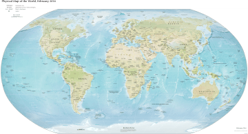
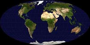
Outline of geography
The following outline is provided as an overview of and topical guide to geography:
Geography – study of earth and its people.[1]
Nature of geography
Geography is
- an academic discipline – a body of knowledge given to − or received by − a disciple (student); a branch or sphere of knowledge, or field of study, that an individual has chosen to specialize in. Modern geography is an all-encompassing discipline that seeks to understand the Earth and all of its human and natural complexities − not merely where objects are, but how they have changed and come to be. Geography has been called 'the world discipline'.[2]
- a field of science – widely recognized category of specialized expertise within science, and typically embodies its own terminology and nomenclature. Such a field will usually be represented by one or more scientific journals, where peer reviewed research is published. There are many geography-related scientific journals.
- a natural science – field of academic scholarship that explores aspects of natural environment (physical geography).
- a social science – field of academic scholarship that explores aspects of human society (human geography).
- an interdisciplinary field – a field that crosses traditional boundaries between academic disciplines or schools of thought, as new needs and professions have emerged. Many of the branches of physical geography are also branches of Earth science.
Branches of geography
As "the bridge between the human and physical sciences," geography is divided into two main branches:
Other branches include:
- integrated geography
- geomatics
- regional geography
All the branches are further described below...
Physical geography
- Physical geography – examines the natural environment and how the climate, vegetation & life, soil, water, and landforms are produced and interact.[5]
Fields of physical geography
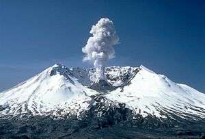
- Geomorphology – study of landforms and the processes that them, and more broadly, of the processes controlling the topography of any planet. Seeks to understand why landscapes look the way they do, to understand landform history and dynamics, and to predict future changes through a combination of field observation, physical experiment, and numerical modeling.
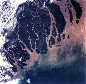
- Hydrology – study of the movement, distribution, and quality of water throughout the Earth, including the hydrologic cycle, water resources and environmental watershed sustainability.
- Glaciology – study of glaciers, or more generally ice and natural phenomena that involve ice.
- Oceanography – studies a wide range of topics pertaining to oceans, including marine organisms and ecosystem dynamics; ocean currents, waves, and geophysical fluid dynamics; plate tectonics and the geology of the sea floor; and fluxes of various chemical substances and physical properties within the ocean and across its boundaries.
- Biogeography – study of the distribution of species spatially and temporally. Over areal ecological changes, it is also tied to the concepts of species and their past, or present living 'refugium', their survival locales, or their interim living sites. It aims to reveal where organisms live, and at what abundance.[6]
- Climatology – study of climate, scientifically defined as weather conditions averaged over a period of time.[7]
- Meteorology is the interdisciplinary scientific study of the atmosphere that focuses on weather processes and short term forecasting (in contrast with climatology).
- Pedology – study of soils in their natural environment[8] that deals with pedogenesis, soil morphology, and soil classification.
- Palaeogeography – study of what the geography was in times past, most often concerning the physical landscape, but also the human or cultural environment.
- Coastal geography – study of the dynamic interface between the ocean and the land, incorporating both the physical geography (i.e. coastal geomorphology, geology and oceanography) and the human geography (sociology and history) of the coast. It involves an understanding of coastal weathering processes, particularly wave action, sediment movement and weather, and also the ways in which humans interact with the coast.
- Quaternary science – focuses on the Quaternary period, which encompasses the last 2.6 million years, including the last ice age and the Holocene period.
- Landscape ecology – the relationship between spatial patterns of urban development and ecological processes on a multitude of landscape scales and organizational levels.[9][10][11]
Approaches of physical geography
- Quantitative geography – Quantitative research tools and methods applied to geography. See also the quantitative revolution.
- Systems approach –
Human geography
- Human geography – one of the two main subfields of geography, it is the study of human use and understanding of the world and the processes which have affected it. Human geography broadly differs from physical geography in that it focuses on the built environment and how space is created, viewed, and managed by humans as well as the influence humans have on the space they occupy.[5]
Fields of human geography
- Cultural geography – study of cultural products and norms and their variations across and relations to spaces and places. It focuses on describing and analyzing the ways language, religion, economy, government and other cultural phenomena vary or remain constant, from one place to another and on explaining how humans function spatially.[12]
- Children's geographies – study of places and spaces of children's lives, characterized experientially, politically and ethically. Children's geographies rests on the idea that children as a social group share certain characteristics which are experientially, politically and ethically significant and which are worthy of study. The pluralisation in the title is intended to imply that children's lives will be markedly different in differing times and places and in differing circumstances such as gender, family, and class. The range of foci within children's geographies include:
- Children and the city
- Children and the countryside
- Children and technology
- Children and nature,
- Children and globalization
- Methodologies of researching children's worlds
- Ethics of researching children's worlds
- Otherness of childhood
- Animal geographies – studies the spaces and places occupied by animals in human culture, because social life and space is heavily populated by animals of many differing kinds and in many differing ways (e.g. farm animals, pets, wild animals in the city). Another impetus that has influenced the development of the field are ecofeminist and other environmentalist viewpoints on nature-society relations (including questions of animal welfare and rights).
- Language geography – studies the geographic distribution of language or its constituent elements. There are two principal fields of study within the geography of language:
- Sexuality and space – encompasses all relationships and interactions between human sexuality, space, and place, including the geographies of LGBT residence, public sex environments, sites of queer resistance, global sexualities, sex tourism,[19] the geographies of prostitution and adult entertainment, use of sexualised locations in the arts,[20][21] and sexual citizenship.[22]
- Religion geography – study of the influence of geography, i.e. place and space, on religious belief.[23]
- Children's geographies – study of places and spaces of children's lives, characterized experientially, politically and ethically. Children's geographies rests on the idea that children as a social group share certain characteristics which are experientially, politically and ethically significant and which are worthy of study. The pluralisation in the title is intended to imply that children's lives will be markedly different in differing times and places and in differing circumstances such as gender, family, and class. The range of foci within children's geographies include:
- Development geography – study of the Earth's geography with reference to the standard of living and quality of life of its human inhabitants. Measures development by looking at economic, political and social factors, and seeks to understand both the geographical causes and consequences of varying development, in part by comparing More Economically Developed Countries (MEDCs) with Less Economically Developed Countries (LEDCs).
- Economic geography – study of the location, distribution and spatial organization of economic activities across the world. Subjects of interest include but are not limited to the location of industries, economies of agglomeration (also known as "linkages"), transportation, international trade and development, real estate, gentrification, ethnic economies, gendered economies, core-periphery theory, the economics of urban form, the relationship between the environment and the economy (tying into a long history of geographers studying culture-environment interaction), and globalization.
- Marketing geography – a discipline within marketing analysis which uses geolocation (geographic information) in the process of planning and implementation of marketing activities.[24] It can be used in any aspect of the marketing mix – the product, price, promotion, or place (geo targeting).
- Transportation geography – branch of economic geography that investigates spatial interactions between people, freight and information. It studies humans and their use of vehicles or other modes of traveling as well as how markets are serviced by flows of finished goods and raw materials.
- Health geography – application of geographical information, perspectives, and methods to the study of health, disease, and health care, to provide a spatial understanding of a population's health, the distribution of disease in an area, and the environment's effect on health and disease. It also deals with accessibility to health care and spatial distribution of health care providers.
- Time geography – study of the temporal factor on spatial human activities within the following constraints:
- Authority - limits of accessibility to certain places or domains placed on individuals by owners or authorities
- Capability - limitations on the movement of individuals, based on their nature. For example, movement is restricted by biological factors, such as the need for food, drink, and sleep
- Coupling - restraint of an individual, anchoring him or her to a location while interacting with other individuals in order to complete a task
- Historical geography – study of the human, physical, fictional, theoretical, and "real" geographies of the past, and seeks to determine how cultural features of various societies across the planet emerged and evolved, by understanding how a place or region changes through time, including how people have interacted with their environment and created the cultural landscape.
- Political geography – study of the spatially uneven outcomes of political processes and the ways in which political processes are themselves affected by spatial structures. Basically, the inter-relationships between people, state, and territory.
- Electoral geography – study of the relationship between election results and the regions they affect (such as the environmental impact of voting decisions), and of the effects of regional factors upon voting behavior.
- Geopolitics – analysis of geography, history and social science with reference to spatial politics and patterns at various scales, ranging from the level of the state to international.
- Strategic geography – concerned with the control of, or access to, spatial areas that affect the security and prosperity of nations.
- Military geography – the application of geographic tools, information, and techniques to solve military problems in peacetime or war.
- Population geography – study of the ways in which spatial variations in the distribution, composition, migration, and growth of populations are related to the nature of places.
- Tourism geography – study of travel and tourism, as an industry and as a social and cultural activity, and their effect on places, including the environmental impact of tourism, the geographies of tourism and leisure economies, answering tourism industry and management concerns and the sociology of tourism and locations of tourism.
- Urban geography – the study of urban areas, in terms of concentration, infrastructure, economy, and environmental impacts.
Approaches of human geography
- Behavioral geography – An approach to human geography that examines human behavior using a disaggregate approach
- Cognitive geography – An interdisciplinary study of cognitive science and geography
- Critical geography – Variant of social science that seeks to interpret and change the world
- Feminist geography – An approach in human geography which applies the theories, methods and critiques of feminism
- Marxist geography – A strand of critical geography that uses the theories and philosophy of Marxism to examine the spatial relations of human geography
- Non-representational theory
- Postcolonialism – The academic study of the cultural legacy of colonialism and imperialism
- Post-structuralism[25] –
- Qualitative geography – qualitative research tools and methods applied to geography.
Integrated geography
- Integrated geography – branch of geography that describes the spatial aspects of interactions between humans and the natural world. It requires an understanding of the dynamics of geology, meteorology, hydrology, biogeography, ecology, and geomorphology, as well as the ways in which human societies conceptualize the environment.
Geomatics
- Geomatics – branch of geography and the discipline of gathering, storing, processing, and delivering geographic information, or spatially referenced information. It is a widespread interdisciplinary field that includes the tools and techniques used in land surveying, remote sensing, cartography, Geographic Information Systems (GIS), Global Navigation Satellite Systems, photogrammetry, and related forms of earth mapping.
Fields contributing to geomatics
- Photogrammetry – Taking measurements using photography
- Cartography – The study and practice of making maps
- Digital terrain modelling
- Geodesy – The science of the geometric shape, orientation in space, and gravitational field of Earth
- Geographic information system – System to capture, manage and present geographic data
- Geospatial
- Global navigation satellite systems represented by Satellite navigation – use of satellite signals for geo-spatial positioning – Any system that uses satellite radio signals to provide autonomous geo-spatial positioning
- Global Positioning System – American satellite navigation system
- Hydrography – Applied science of measurement and description of physical features of bodies of water
- Mathematics – Field of study
- Navigation – Process of monitoring and controlling the movement of a craft or vehicle from one place to another
- Remote sensing – Acquisition of information at a significant distance from the subject
- Surveying – The technique, profession, and science of determining the positions of points and the distances and angles between them
Regional geography
Regional geography – study of world regions. Attention is paid to unique characteristics of a particular region such as its natural elements, human elements, and regionalization which covers the techniques of delineating space into regions. Regional geography breaks down into the study of specific regions.
Region – an area, defined by physical characteristics, human characteristics, or functional characteristics. The term is used in various ways among the different branches of geography. A region can be seen as a collection of smaller units, such as a country and its political divisions, or as one part of a larger whole, as in a country on a continent.
Supercontinents
List of supercontinents A supercontinent is a landmass comprising more than one continental core, or craton.
- Afro-Eurasia (formed 5 million years ago)
- Americas (formed 15 million years ago)
- Eurasia (formed 60 million years ago)
Continents
Continent – one of several large landmasses on Earth. They are generally identified by convention rather than any specific criteria, but seven areas are commonly regarded as continents. They are:
- 1. Africa (outline) –
- 2. Antarctica –
- 3. Australia (outline) –
- The Americas:
- 4. North America (outline) –
- 5. South America (outline) –
- Eurasia:
Biogeographic regions
Biogeographic realm
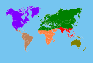
The World Wildlife Fund (WWF) developed a system of eight biogeographic realms (ecozones):
- Nearctic 22.9 mil. km² (including most of North America)
- Palearctic 54.1 mil. km² (including the bulk of Eurasia and North Africa)
- Afrotropic 22.1 mil. km² (including Sub-Saharan Africa)
- Indomalaya 7.5 mil. km² (including the South Asian subcontinent and Southeast Asia)
- Australasia 7.7 mil. km² (including Australia, New Guinea, and neighboring islands). The northern boundary of this zone is known as the Wallace line.
- Neotropic 19.0 mil. km² (including South America and the Caribbean)
- Oceania 1.0 mil. km² (including Polynesia, Fiji and Micronesia)
- Antarctic 0.3 mil. km² (including Antarctica).
Ecoregions
Ecoregion Biogeographic realms are further divided into ecoregions. The World has over 800 terrestrial ecoregions. See Lists of ecoregions by country.
Geography of the political divisions of the World
Other regions
- Atlantic World
- Bermuda Triangle
- Pacific Rim
- Pacific Ring of Fire
History of geography

Topics pertaining to the geographical study of the World throughout history:
By period
- Ancient roads
- Ancient Greek geography
- Age of discovery
- Major explorations after the Age of Discovery
- Critical geography
- Environmental determinism
By region
- Chinese geography – The sudy of geography in China since the 5th century BC
By subject
By field
- History of human geography
- History of cartography – The development of cartography, or mapmaking technology
- History of cultural geography
- History of economic geography
- History of health geography
- History of political geography
- History of physical geography
- History of regional geography
Elements of geography
Topics common to the various branches of geography include:
Tasks and tools of geography
- Exploration – The act of traveling and searching for resources or for information about the land or space itself
- Geocode, also known as Geospatial Entity Object Code – Geospatial coordinate system for specifying the exact location of a geospatial point at, below, or above the surface of the earth at a given moment of time.
- Geographic information system (GIS) – System to capture, manage and present geographic data
- Globe – A three-dimensional scale model of a spheroidal celestial body
- Map – A symbolic depiction of relationships between elements of some space
- Atlas – collection of maps
- Cartography – The study and practice of making maps
- Outline of cartography – 1=Overview of and topical guide to cartography
- Map projection – Systematic representation of the surface of a sphere or ellipsoid onto a plane
- Demographics
- Spatial analysis – Formal techniques which study entities using their topological, geometric, or geographic properties
- Surveying – The technique, profession, and science of determining the positions of points and the distances and angles between them
Types of geographic features
Geographic feature – component of a planet that can be referred to as a location, place, site, area, or region, and therefore may show up on a map. A geographic feature may be natural or artificial.
Location and place

- Location –
- Absolute location
- Latitude – geographic coordinate specifying north–south position
- Prime meridian – A line of longitude, at which longitude is defined to be 0°
- Longitude – geographic coordinate that specifies the east-west position of a point on the Earth's surface
- Equator – Intersection of a sphere's surface with the plane perpendicular to the sphere's axis of rotation and midway between the poles
- Tropic of Cancer – Line of northernmost latitude at which the sun can be directly overhead
- Tropic of Capricorn – Line of southernmost latitude at which the sun can be directly overhead
- Arctic Circle – Boundary of the Arctic
- Antarctic Circle – Boundary of the Antarctic
- North Pole – Northern point where the Earth's axis of rotation intersects its surface
- South Pole – Southern point where the Earth's axis of rotation intersects its surface
- Altitude – Height in relation to a specified reference point
- Elevation – Height of a geographic location above a fixed reference point
- Latitude – geographic coordinate specifying north–south position
- Absolute location
- Place
- Aspects of a place or region
- Climate – Statistics of weather conditions in a given region over long periods
- Population – All the organisms of a given species that live in the specified region
- Demographics
- Population density – A measurement of population numbers per unit area or volume
- Human overpopulation – Condition where human numbers exceed the short or long-term carrying capacity of the environment
- World population – The total number of living humans on Earth
- Demographics
- Sense of place – A term used in behavioral sciences and urban planning
- Terrain – Vertical and horizontal dimension and shape of land surface
- Topography – The study of the shape and features of the surface of the Earth and other observable astronomical objects
- Tourist attraction – Place of interest where tourists visit
- Lists of places – A list of Wikipedia's list articles of places on earth sorted by category
- Aspects of a place or region
Natural geographic features
Natural geographic feature – an ecosystem or natural landform.
Ecosystems
Ecosystem – community of living organisms in conjunction with the nonliving components of their environment (things like air, water and mineral soil), interacting as a system. These biotic and abiotic components are regarded as linked together through nutrient cycles and energy flows.
- Biodiversity hotspot – A biogeographic region with significant levels of biodiversity that is threatened with destruction
- Realm – broadest biogeographic division of the Earth's land surface, based on distributional patterns of terrestrial organisms.
- Ecoprovince – biogeographic unit smaller than a realm that contains one or more ecoregions.
- Ecoregion – Ecologically and geographically defined area that is smaller than a bioregion
- Ecodistrict – Term used in urban planning to integrate objectives of sustainable development and reduce ecological impact
- Ecosection
- Ecosite
- Ecotope – The smallest ecologically distinct landscape features in a landscape mapping and classification system
- Ecoelement
- Ecotope – The smallest ecologically distinct landscape features in a landscape mapping and classification system
- Ecosite
- Ecoregion – Ecologically and geographically defined area that is smaller than a bioregion
- Ecoprovince – biogeographic unit smaller than a realm that contains one or more ecoregions.
- Biome – Distinct biological communities that have formed in response to a shared physical climate
Natural landforms
Natural landform – terrain or body of water. Landforms are topographical elements, and are defined by their surface form and location in the landscape. Landforms are categorized by traits such as elevation, slope, orientation, stratification, rock exposure, and soil type. Some landforms are artificial, such as certain islands, but most landforms are natural.
Natural terrain feature types
- Continent – Very large landmass identified by convention
- Island – Any piece of sub-continental land that is surrounded by water
- Mainland – The continental part of any polity or the main island within an island nation
- Mountain – A large landform that rises fairly steeply above the surrounding land over a limited area
- Mountain range – A geographic area containing several geologically related mountains
- Subcontinent – A large, relatively self-contained landmass forming a subdivision of a continent
Natural body of water types
- Natural bodies of water – Any significant accumulation of water, generally on a planet's surface
- Bodies of seawater – Water from a sea or ocean
- Channel – A type of landform in which part of a body of water is confined to a relatively narrow but long region
- Firth – Scottish word used for various coastal inlets and straits
- Harbor – Sheltered body of water where ships may shelter
- Inlet – An indentation of a shoreline that often leads to an enclosed body of salt water, such as a sound, bay, lagoon, or marsh
- Bay – Coastal landforms
- Cove – A small sheltered bay or coastal inlet
- Creek (tidal)
- Estuary – Partially enclosed coastal body of brackish water with one or more rivers or streams flowing into it, and with a free connection to the open sea
- Fjord – A long, narrow inlet with steep sides or cliffs, created by glacial activity
- Kettle – A depression/hole in an outwash plain formed by retreating glaciers or draining floodwaters
- Kill – A creek, tidal inlet, river, strait, or arm of the sea
- Lagoon – A shallow body of water separated from a larger body of water by barrier islands or reefs
- Barachois – A coastal lagoon partially or totally separated from the ocean by a sand or shingle bar
- Loch – Scottish Gaelic, Scots and Irish word for a lake or a sea inlet
- Arm of the sea –
- Mere
- Ocean – A body of water that composes much of a planet's hydrosphere
- Phytotelma – A small water-filled cavity in a terrestrial plant
- Salt marsh – Coastal ecosystem between land and open saltwater that is regularly flooded
- Sea – Large body of salt water
- Types of sea:
- Mediterranean sea – A mostly enclosed sea with limited exchange with outer oceans
- Sound – A long, relatively wide body of water, connecting two larger bodies of water
- Sea components or extensions:
- Sea loch – Scottish Gaelic and Irish word for a sea inlet
- Sea lough – Anglicised version of Scottish Gaelic and Irish word for a sea inlet
- Types of sea:
- Strait – A naturally formed, narrow, typically navigable waterway that connects two larger bodies of water
- Bodies of fresh water
- Bayou – French term for a body of water typically found in flat, low-lying area
- Lake – A body of relatively still water, in a basin surrounded by land
- Lists of lakes – A list of lists of lakes
- Oxbow lake – U-shaped lake formed by a cut-off meander of a river
- Subglacial lake – A lake under a glacier
- Tarn – Mountain lake or pool in a glacial cirque
- Pool – A stretch of a river or stream in which the water is relatively deep and slow moving
- Pond – A relatively small body of standing water
- Billabong – Australian term for a seasonal oxbow lake
- Tide pool – A rocky pool on a seashore, separated from the sea at low tide, filled with seawater
- Vernal pool – Seasonal pools of water that provide habitat for distinctive plants and animals
- Puddle – A small accumulation of liquid, usually water, on a surface
- Pond – A relatively small body of standing water
- River – Natural flowing watercourse
- Lists of rivers – A list of rivers, organised geographically
- Parts of a river:
- Rapid – A section of a river where the river bed is relatively steep, increasing the water's velocity and turbulence
- Source
- Waterfall – Place where water flows over a vertical drop in the course of a river
- List of waterfalls – List of notable waterfalls of the world
- Lists of rivers – A list of rivers, organised geographically
- Roadstead – An open anchorage affording some, but less protection than a harbor
- Spring – A point at which water emenges from an aquifer to the surface
- Boil -
- Stream – A body of surface water flowing down a channel
- Beck – A body of surface water flowing down a channel
- Brook – A body of surface water flowing down a channel
- Burn – Term of Scottish origin for a small river
- Creek – A body of surface water flowing down a channel
- Arroyo (creek) – A dry creek or stream bed with flow after rain
- Run – A body of surface water flowing down a channel
- Wetland – land area that is permanently or seasonally saturated with water
- Freshwater marsh – wetland that is dominated by herbaceous rather than woody plant species
- Slough (wetland) – A forested wetland
- Mangrove swamp – A shrub or small tree that grows in coastal saline or brackish water
- Bodies of seawater – Water from a sea or ocean
Artificial geographic features
Artificial geographic feature – a thing that was made by humans that may be indicated on a map. It may be physical and exist in the real world (like a bridge or city), or it may be abstract and exist only on maps (such as the Equator, which has a defined location, but cannot be seen where it lies).
- Settlement – Community of any size, in which people live
- Hamlet (place) – Small human settlement in a rural area – rural settlement which is too small to be considered a village. Historically, when a hamlet became large enough to justify building a church, it was then classified as a village. One example of a hamlet is a small cluster of houses surrounding a mill.
- Village – Small clustered human settlement smaller than a town – clustered human settlement or community, larger than a hamlet with the population ranging from a few hundred to a few thousand (sometimes tens of thousands).
- Town – Settlement that is bigger than a village but smaller than a city – human settlement larger than a village but smaller than a city. The size a settlement must be in order to be called a "town" varies considerably in different parts of the world, so that, for example, many American "small towns" seem to British people to be no more than villages, while many British "small towns" would qualify as cities in the United States.
- Urban hierarchy – ranks the structure of towns within an area.
- 1st-order towns – bare minimum of essential services, such as bread and milk.
- 2nd-order towns
- 3rd-order towns
- 4th-order towns
- Urban hierarchy – ranks the structure of towns within an area.
- City – Large and permanent human settlement – relatively large and permanent settlement. In many regions, a city is distinguished from a town by attainment of designation according to law, for instance being required to obtain articles of incorporation or a royal charter.
- Financial centre – Locations which are centres of financial activity
- Primate city – the leading city in its country or region, disproportionately larger than any others in the urban hierarchy.
- Metropolis – very large city or urban area which is a significant economic, political and cultural center for a country or region, and an important hub for regional or international connections and communications.
- Metropolitan area – region consisting of a densely populated urban core and its less-populated surrounding territories, sharing industry, infrastructure, and housing.[27]
- Global city – City which is important to the world economy – city that is deemed to be an important node in the global economic system. Globalization is largely created, facilitated and enacted in strategic geographic locales (including global cities) according to a hierarchy of importance to the operation of the global system of finance and trade.
- Megalopolis – chain of roughly adjacent metropolitan areas. An example is the huge metropolitan area along the eastern seaboard of the U.S. extending from Boston, Massachusetts through New York City; Philadelphia, Pennsylvania; Baltimore, Maryland and ending in Washington, D.C..
- Eperopolis – theoretical "continent city". The world does not have one yet. Will Europe become the first one?
- Ecumenopolis – theoretical "world city". Will the world ever become so urbanized as to be called this?
- Engineered construct – built feature of the landscape such as a highway, bridge, airport, railroad, building, dam, or reservoir. See also construction engineering and infrastructure.
- Artificial landforms
- Artificial dwelling hill – Raised ground to provide a refuge from flooding
- Artificial island – An island constructed by people
- Artificial reef – A man-made underwater structure, typically built to promote marine life, control erosion, block ship passage, block the use of trawling nets, or improve surfing
- Airport – place where airplanes can take off and land, including one or more runways and one or more passenger terminals.
- Aqueduct – artificial channel that is constructed to convey water from one location to another.
- Breakwater – Structure constructed on coasts as part of coastal management or to protect an anchorage – construction designed to break the force of the sea to provide calm water for boats or ships, or to prevent erosion of a coastal feature.
- Bridge – structure built to span physical obstacles – structure built to span a valley, road, body of water, or other physical obstacle such as a canyon, for the purpose of providing passage over the obstacle.
- Building – Structure, typically with a roof and walls, standing more or less permanently in one place – closed structure with walls and a roof.
- Canal – Man-made channel for water – artificial waterway, often connecting one body of water with another.
- Causeway – Route raised up on an embankment
- Dam – A barrier that stops or restricts the flow of surface or underground streams – structure placed across a flowing body of water to stop the flow, usually to use the water for irrigation or to generate electricity.
- Farm – place where agricultural activities take place, especially the growing of crops or the raising of livestock.
- Manmade harbor – Sheltered body of water where ships may shelter – harbor that has deliberately constructed breakwaters, sea walls, or jettys, or which was constructed by dredging.
- Industrial region – Geographical region with a high proportion of industrial use
- Marina – A dock or basin with moorings and facilities for yachts and small boats
- Orchard – Intentionally planted trees or shrubs that are maintained for food production
- Parking lot – Cleared area that is intended for parking vehicles
- Pier – Raised structure in a body of water, typically supported by well-spaced piles or pillars
- Pipeline – Mode of transporting fluids over long distances through sealed pipes
- Port – maritime commercial facility
- Railway – Structure comprising load-bearing rails on a load-spreading foundation intended to carry special-purpose wheeled vehicles
- Ranch – Area of land used for raising grazing livestock
- Reservoir – Bulk storage space for water
- Road – A demarcated land route with a suitable surface between places
- Highway – A public road or other public way on land
- Race track – Facility built for racing of animals, vehicles, or athletes
- Street – A public thoroughfare in a built environment
- Subsidence crater – A hole or depression left on the surface over the site of an underground explosion.
- Ski resort – Resort developed for skiing, snowboarding, and other winter sports
- Train station – Railway facility where trains regularly stop to load or unload passengers and/or freight
- Tree farm – Plantation for the cultivation of trees for harvest
- Tunnel – An underground passage made for traffic
- Viaduct – A multiple span bridge crossing an extended lower area
- Wharf – A structure on the shore of a harbor or on the bank of a river or canal where ships dock
- Artificial landforms
- Abstract geographic feature – does not exist physically in the real world, yet has a location by definition and may be displayed on maps.
- Geographical zone – Major regions of Earth's surface demarcated by latitude
- Hardiness zone – Geographical regions defined by climatic conditions for horticultural purposes
- Time zone – Region on Earth that has a uniform standard time for legal, commercial, and social purposes
- Political division – A territorial entity for administration purposes
- Nation – Stable community of people based on a common cultural or political identity
- Administrative division – A territorial entity for administration purposes
- Special Economic Zone – A geographical region in which business and trade laws are different from the rest of the country
- Country subdivision – A territorial entity for administration purposes – a designated territory created within a country for administrative or identification purposes. Examples of the types of country subdivisions:
- Bailiwick – The area of jurisdiction of a bailiff
- Canton – A type of administrative division of a country
- Commune – An urban administrative division having corporate status and usually some powers of self-government or jurisdiction
- County – Geographical and administrative region in some countries
- Department – Administrative or political subdivision in some countries
- District – Administrative division, in some countries, managed by local government
- Duchy – Territory, fief, or domain ruled by, or representing the title of, a duke or duchess
- Emirate – A political territory that is ruled by a dynastic Muslim monarch styled emir
- Federal state – A union of partially self-governing states or territories, united by a central (federal) government that exercizes directly on them its sovereign power
- Parish – Ecclesiastical subdivision of a diocese
- Prefecture – An administrative jurisdiction or subdivision in any of various countries
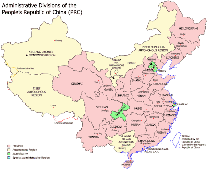
- Province – A major administrative subdivision within a country or sovereign state
- Region – Two or three dimensionally defined space, mainly in terrestrial and astrophysics sciences
- Rural district – Former type of local government area in England, Wales, and Ireland
- Settlement – Community of any size, in which people live
- Municipality – Administrative division having corporate status and usually some powers of self-government or jurisdiction
- City – Large and permanent human settlement
- Village – Small clustered human settlement smaller than a town
- Shire – A traditional term for a division of land, found in some English-speaking countries
- State – A territorial and constitutional community forming part of a federal union
- Subdistrict – A low-level administrative division of a country
- Subprefecture – Administrative division of a country that is below prefecture
- Voivodeship – Administrative division in several countries of central and eastern Europe
- Wilayat – Administrative division approximating a state or province
- Cartographical feature – theoretical construct used specifically on maps that doesn't have any physical form apart from its location.
- Latitude line – geographic coordinate specifying north–south position
- Equator – Intersection of a sphere's surface with the plane perpendicular to the sphere's axis of rotation and midway between the poles
- Longitude line – geographic coordinate that specifies the east-west position of a point on the Earth's surface
- Prime Meridian – A line of longitude, at which longitude is defined to be 0°
- Geographical pole – Points on a rotating astronomical body where the axis of rotation intersects the surface
- North pole – Northern point where the Earth's axis of rotation intersects its surface
- South pole – Southern point where the Earth's axis of rotation intersects its surface
- Latitude line – geographic coordinate specifying north–south position
- Geographical zone – Major regions of Earth's surface demarcated by latitude
Geographic features that include the natural and artificial
- Waterway – Any navigable body of water
- List of waterways – List of navigable rivers, canals, estuaries, lakes, and firths
Geography awards

Some awards and competitions in the field of geography:
- Geography Cup – An online, international competition between the United States and the United Kingdom, with the aim of determining which nation collectively knows more about geography
- Gold Medal – Award presented by the Royal Geographical Society
- Hubbard Medal – Medal awarded by the National Geographic Society for distinction in exploration, discovery, and research
- National Geographic World Championship – A biennial, two-day-long international geography competition
- Victoria Medal – Award presented by the Royal Geographical Society for conspicuous merit in research in geography
Persons influential in geography
A geographer is a scientist who studies Earth's physical environment and human habitat. Geographers are historically known for making maps, the subdiscipline of geography known as cartography. They study the physical details of the environment and also its effect on human and wildlife ecologies, weather and climate patterns, economics, and culture. Geographers focus on the spatial relationships between these elements.
Influential physical geographers

- Eratosthenes (276 – 194 BC) – who made the first known reliable estimation of the Earth's size.[29] He is considered the father of geodesy.[29][30]
- Ptolemy (c.90 – c.168) – who compiled Greek and Roman knowledge to produce the book Geographia.
- Abū Rayhān Bīrūnī (973 – 1048 AD) – considered the father of geodesy.[31][32]
- Ibn Sina (Avicenna, 980–1037) – whose observations in Kitab Al-Shifa contributed to later formulations of the law of superposition and concept of uniformitarianism.[33]
- Muhammad al-Idrisi (Dreses, 1100 – c.1165) – who drew the Tabula Rogeriana, the most accurate world map in pre-modern times.[34]
- Piri Reis (1465 – c.1554) – whose Piri Reis map is the oldest surviving world map to include the Americas and possibly Antarctica
- Gerardus Mercator (1512–1594) – an innovative cartographer and originator of the Mercator projection.
- Bernhardus Varenius (1622–1650) – Wrote his important work "General Geography" (1650) – first overview of the geography, the foundation of modern geography.
- Mikhail Lomonosov (1711–1765) – father of Russian geography and founded the study of glaciology.
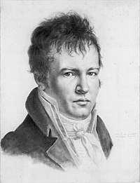
- Alexander Von Humboldt (1769–1859) – considered the father of modern geography. Published Kosmos and founded the study of biogeography.
- Arnold Henry Guyot (1807–1884) – who noted the structure of glaciers and advanced the understanding of glacial motion, especially in fast ice flow.
- Louis Agassiz (1807–1873) – the author of a glacial theory which disputed the notion of a steady-cooling Earth.
- Alfred Russel Wallace (1823–1913) – founder of modern biogeography and the Wallace line.
- Vasily Dokuchaev (1846–1903) – patriarch of Russian geography and founder of pedology.
- Wladimir Peter Köppen (1846–1940) – developer of most important climate classification and founder of Paleoclimatology.
- William Morris Davis (1850–1934) – father of American geography, founder of Geomorphology and developer of the geographical cycle theory.
- Walther Penck (1888–1923) – proponent of the cycle of erosion and the simultaneous occurrence of uplift and denudation.
- Sir Ernest Shackleton (1874–1922) – Antarctic explorer during the Heroic Age of Antarctic Exploration.
- Robert E. Horton (1875–1945) – founder of modern hydrology and concepts such as infiltration capacity and overland flow.
- J Harlen Bretz (1882–1981) – pioneer of research into the shaping of landscapes by catastrophic floods, most notably the Bretz (Missoula) floods.
- Willi Dansgaard (born 1922) – palaeoclimatologist and quaternary scientist, instrumental in the use of oxygen-isotope dating and co-identifier of Dansgaard-Oeschger events.
- Hans Oeschger (1927–1998) – palaeoclimatologist and pioneer in ice core research, co-identifier of Dansgaard-Orschger events.
- Richard Chorley (1927–2002) – a key contributor to the quantitative revolution and the use of systems theory in geography.
- Sir Nicholas Shackleton (1937–2006) – who demonstrated that oscillations in climate over the past few million years could be correlated with variations in the orbital and positional relationship between the Earth and the Sun.
- Stefan Rahmstorf (born 1960) – professor of abrupt climate changes and author on theories of thermohaline dynamics.
Influential human geographers

- Carl Ritter (1779–1859) – considered to be one of the founding fathers of modern geography and first chair in geography at the Humboldt University of Berlin, also noted for his use of organic analogy in his works.
- Friedrich Ratzel (1844–1904) – environmental determinist, invented the term Lebensraum
- Paul Vidal de la Blache (1845–1918) – founder of the French School of geopolitics and possibilism.
- Sir Halford John Mackinder (1861–1947) – author of The Geographical Pivot of History, co-founder of the London School of Economics, along with the Geographical Association.
- Carl O. Sauer (1889–1975) – critic of environmental determinism and proponent of cultural ecology.
- Walter Christaller (1893–1969) – economic geographer and developer of the central place theory.
- Richard Hartshorne (1899–1992) – scholar of the history and philosophy of geography.
- Torsten Hägerstrand (1916–2004) – critic of the quantitative revolution and regional science, noted figure in critical geography.
- Milton Santos (1926–2001) winner of the Vautrin Lud prize in 1994, one of the most important geographers in South America.
- Waldo R. Tobler (born 1930) – developer of the First law of geography.
- Yi-Fu Tuan (born 1930) A Chinese-American geographer.
- David Harvey (born 1935) – world's most cited academic geographer and winner of the Lauréat Prix International de Géographie Vautrin Lud, also noted for his work in critical geography and critique of global capitalism.
- Evelyn Stokes (1936–2005). Professor of geography at the University of Waikato in New Zealand. Known for recognizing inequality with marginalized groups including women and Māori using geography.
- Allen J. Scott (born 1938) – winner of Vautrin Lud Prize in 2003 and the Anders Retzius Gold medal 2009; author of numerous books and papers on economic and urban geography, known for his work on regional development, new industrial spaces, agglomeration theory, global city-regions and the cultural economy.
- Edward Soja (born 1941) – noted for his work on regional development, planning and governance, along with coining the terms synekism and postmetropolis.
- Doreen Massey (born 1944) – key scholar in the space and places of globalization and its pluralities, winner of the Vautrin Lud Prize.
- Michael Watts, Class of 1963 Professor of Geography and Development Studies, University of California, Berkeley
- Nigel Thrift (born 1949) – developer of non-representational theory.
- Derek Gregory (born 1951) – famous for writing on the Israeli, U.S. and UK actions in the Middle East after 9/11, influenced by Edward Said and has contributed work on imagined geographies.
- Cindi Katz (born 1954) – who writes on social reproduction and the production of space. Writing on children's geographies, place and nature, everyday life and security.
- Gillian Rose (born 1962) – most famous for her critique: Feminism & Geography: The Limits of Geographical Knowledge (1993) – which was one of the first moves towards a development of feminist geography.
Geography educational frameworks
Educational frameworks upon which primary and secondary school curricula for geography are based upon include:
- Five themes of geography – educational tool for teaching geography[35]
- Location – a position or point that something occupies on the Earth's surface.
- Place
- Human-environment interaction – The study of interactions between societies and their natural environments
- movement –
- Region – Two or three dimensionally defined space, mainly in terrestrial and astrophysics sciences
- The six "essential elements" identified by the Geography Education Standards Project,[36] under which the National Geography Standards they developed are organized:[37][38]
- The World in spatial terms
- Places and regions
- Physical systems
- Human systems
- Environment and society
- The uses of geography
- The three content areas of geography from the 2010 National Assessment of Educational Progress[39] (U.S.):
- Space and place
- Environment and society
- Spatial dynamics and connections
See also
References
- "Geography". The American Heritage Dictionary/ of the English Language, Fourth Edition. Houghton Mifflin Company. Retrieved October 9, 2006.
- Bonnett, Alastair (2008). What is Geography?. London: Sage. ISBN 9781412918688.
- "Geography: The Mother of Sciences" (PDF). Archived from the original (PDF) on 1 September 2003.
- Pidwirny, M. (2006). "Elements of Geography". Fundamentals of Physical Geography (2nd ed.). Physicalgeography.net.
- "What is geography?". AAG Career Guide: Jobs in Geography and related Geographical Sciences. Association of American Geographers. Archived from the original on October 6, 2006. Retrieved October 9, 2006.
- Martiny JBH et al. Microbial biogeography: putting microorganisms on the map Archived 2010-06-21 at the Wayback Machine Nature: FEBRUARY 2006 | VOLUME 4
- "Climate Glossary". National Weather Service: Climate Prediction Center. NOAA. Archived from the original on 8 February 2007.
- Ronald Amundsen. "Soil Preservation and the Future of Pedology" (PDF). Retrieved 2006-06-08.
- Wu, J. 2006. Cross-disciplinarity, landscape ecology, and sustainability science. Landscape Ecology 21:1-4.
- Wu, J. and R. Hobbs (Eds). 2007. Key Topics in Landscape Ecology. Cambridge University Press, Cambridge.
- Wu, J. 2008. Landscape ecology. In: S. E. Jorgensen (ed), Encyclopedia of Ecology. Elsevier, Oxford.
- Jordan-Bychkov, Terry G.; Domosh, Mona; Rowntree, Lester (1994). The human mosaic: a thematic introduction to cultural geography. New York: HarperCollinsCollegePublishers. ISBN 978-0-06-500731-2.
- Delgado de Carvalho, C.M. (1962). The geography of languages. In Wagner, P.L.; Mikesell, M.W. Readings in cultural geography. Chicago: University of Chicago Press, 75-93.
- Pei, M. (1966). Glossary of linguistic terminology. New York: John Wiley.
- Trudgill, P. (1974). Linguistic change and diffusion: description and explanation in sociolinguistic dialect geography. Language in Society 3:2, 215-46.
- Trudgill, P. (1983). On dialect: social and geographical perspectives. Oxford: Basil Blackwell; New York: New York University Press.
- Trudgill, P. (1975). Linguistic geography and geographical linguistics. Progress in Geography 7, 227-52
- Withers, Charles W.J. [1981] (1993). Johnson, R.J. The Dictionary of Human Geography, Gregory, Derek; Smith, David M., Second edition, Oxford: Blackwell, 252-3.
- Pritchard, Annette; Morgan, Nigel J. (1 January 2000). "Constructing tourism landscapes - gender, sexuality and space". Tourism Geographies. 2 (2): 115–139. doi:10.1080/14616680050027851.
- "Syllabus Poetics: Sexuality and Space in 17th - 19th Century American Literature, University at Buffalo". buffalo.edu. Archived from the original on 2017-04-17. Retrieved 2010-11-05.
- "Space and Modern (Homo)sexuality in Tsai Ming Liang's Films by Lyn Van Swol". allacademic.com.
- "Sexuality and Space, Course Syllabus Towson University". towson.edu. Archived from the original on 2008-02-03. Retrieved 2010-11-05.
- Park, Chris (2004). "Religion and geography". In Hinnells, J (ed.). Routledge Companion to the Study of Religion. Routledge.
- "Recommending Social Events from Mobile Phone Location Data", Daniele Quercia, et al., ICDM 2010
- Harrison, Paul; 2006; "Post-structuralist Theories"; pp122-135 in Aitken, S. and Valentine, G. (eds); 2006; Approaches to Human Geography; Sage, London
- "West Asia/Middle East". Retrieved 6 May 2015.
- Squires, G. Ed. Urban Sprawl: Causes, Consequences, & Policy Responses. The Urban Institute Press (2002)
- Henry Petroski (2006). "Levees and Other Raised Ground". 94 (1). American Scientist: 7–11. Cite journal requires
|journal=(help) - Avraham Ariel, Nora Ariel Berger (2006)."Plotting the globe: stories of meridians, parallels, and the international". Greenwood Publishing Group. p.12. ISBN 0-275-98895-3
- Jennifer Fandel (2006)."The Metric System". The Creative Company. p.4. ISBN 1-58341-430-4
- Akbar S. Ahmed (1984). "Al-Beruni: The First Anthropologist", RAIN 60, p. 9-10.
- H. Mowlana (2001). "Information in the Arab World", Cooperation South Journal 1.
- Kusky, Timothy M.; Cullen, Katherine E. (2010-01-01). Encyclopedia of Earth and Space Science. Infobase Publishing. p. 817. ISBN 9781438128597.
- Scott, S. P. (1904). History of the Moorish Empire in Europe. p. 461.
The compilation of Edrisi marks an era in the history of science. Not only is its historical information most interesting and valuable, but its descriptions of many parts of the earth are still authoritative. For three centuries geographers copied his maps without alteration. The relative position of the lakes which form the Nile, as delineated in his work, does not differ greatly from that established by Baker and Stanley more than seven hundred years afterwards, and their number is the same.
- Guidelines for Geographic Education—Elementary and Secondary Schools. Joint Committee on Geographic Education of the National Council for Geographic Education and the Association of American Geographers, 1984.
- "The National Geography Standards". Retrieved November 6, 2010.
- "National Geography Standards". Archived from the original on August 25, 2010. Retrieved November 6, 2010.
- Richard G Boehm, Roger M Downs, Sarah W Bednarz. Geography for Life: National Geography Standards. National Council for Geographic Education, 1994
- Geography Framework for the 2010 National Assessment of Educational Progress. National Assessment Governing Board, U.S. Department of Education, p. vii:
It focuses on what geography students should know to be competent and productive 21st century citizens, and uses three content areas for assessing the outcomes of geography education. These content areas are Space and Place, Environment and Society, and Spatial Dynamics and Connections.
External links
- Pidwirny, Michael. (2014). Glossary of Terms for Physical Geography. Planet Earth Publishing, Kelowna, Canada. ISBN 9780987702906. Available on Google Play.
- Pidwirny, Michael. (2014). Understanding Physical Geography. Planet Earth Publishing, Kelowna, Canada. ISBN 9780987702944. Available on Google Play.