Outjo
Outjo (Otjiherero: small hills) is a city[3] of 6,000 inhabitants in the Kunene Region of Namibia. It is the district capital of Outjo Constituency. It is best known as a main gateway to Etosha National Park.[4]
Outjo | |
|---|---|
City | |
.jpg) Aerial view of Outjo (2018) | |
 Seal | |
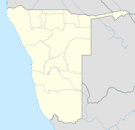 Outjo Location in Namibia | |
| Coordinates: 20°06′32″S 16°09′17″E | |
| Country | |
| Region | Kunene Region |
| Constituency | Outjo Constituency |
| Government | |
| • Mayor | I. Katambo [1] |
| Population (2011)[2] | |
| • Total | 8,445 |
| Time zone | UTC+2 (SAST) |
| Climate | BSh |
Overview
The town was founded by Germans under the command of Colonel Theodor von Leutwein in 1897 as a small military base in order to explore the northern area of German South West Africa. The local historical museum (Franke Haus Museum) details the campaign of Major Viktor Franke in Ovamboland.
The "Naulila monument" commemorates the small expedition on the Portuguese fort of Naulila in Angola by Major Viktor Franke in October 1914 following the massacre of a German delegation which had been sent to negotiate a treaty of non-aggression.
South of Outjo is the Ugab River, one of the major rivers of Namibia.[5] The town lies near Gamkarab Cave, known for its stalactites and stalagmites and its pietersite. The caves are on private ground and not open to the public.
Politics
Outjo is governed by a municipal council that has seven seats.[6]
The 2015 local authority election was won by SWAPO which gained four seats (1,307 votes). Two seats went to the United Democratic Front (UDF, 706 votes), and the remaining seat was won by the Democratic Turnhalle Alliance (DTA) with 381 votes.[7]
| Party | Votes | Percentage | Seats |
|---|---|---|---|
| SWAPO | 1307 | 53,2 % | 4 |
| UDF | 706 | 28,7 % | 2 |
| DTA | 381 | 15,5 % | 1 |
| RDP | 64 | 2,6 % | 0 |
| Total | 2458 | 100 % | 7 |
Transport
Situated on the C38 90 kilometres (56 mi) southwest of Anderson Gate, Outjo is the gateway to the Etosha National Park. Damaraland is also reached by travelling through Outjo on the C39 to Khorixas, and the C40 towards Kamanjab leads to the Kaokoveld.
Outjo has an airstrip about 10 kilometres (6.2 mi) out of town that accommodates small fixed-winged planes. Outjo is the terminus of a branch railway of the Namibian railway system, but there is no railway service at the moment.
Schools
Immediately in Outjo are three primary schools and two secondary schools as well as a combined private school with a total of 2634 students and 96 teachers (as of December 2009).
- Jack Francis Primary School
- Maarssen Primary School
- Outjo Primary School
- Moria Private School
- Etoshapoort Junior Secondary School
- Outjo Secondary School
The following schools are located in the vicinity of the city:
- Otjikondo School Village & Primary School (about 85 kilometers northwest of the city)
- St. Michael Roman-Catholic Primary School (about 70 kilometers northwest of the city)
Touristic Attractions

Outjo offers some sights, but it is above all an important tourist transit and supply point. In 2006, more than 22,000 tourists were counted per month.
- Franke-Haus-Museum
- Naulila monument
- The Water Tower Outjo, which was originally equipped with a wooden wind turbine, was used for water extraction.
Near the city is fingerlike rock formation created through erosion called Vingerklip (its mostly used Afrikaans name).
References
- Outjo Municipality
- "Table 4.2.2 Urban population by Census years (2001 and 2011)" (PDF). Namibia 2011 - Population and Housing Census Main Report. Namibia Statistics Agency. p. 39. Retrieved 24 August 2016.
- "Local Authorities". Association of Local Authorities in Namibia (ALAN). Archived from the original on 10 June 2013. Retrieved 1 October 2012.
- "Outjo - town in Namibia". namibweb.com. Retrieved 27 September 2011.
- Jacobson, Peter J.; Jacobson, Kathryn M.; Seely, Mary K. (1995). Ephemeral rivers and their catchments: Sustaining people and development in western Namibia (PDF 8.7MB). Windhoek: Desert Research Foundation of Namibia. pp. 134–135. ISBN 9991670947.
- "Know Your Local Authority". Election Watch (3). Institute for Public Policy Research. 2015. p. 4.
- "Local elections results". Electoral Commission of Namibia. 28 November 2015. p. 5. Archived from the original on 10 December 2015.