Oranjemund
Oranjemund (German for "Mouth of Orange") is a diamond mining town of 4,000 inhabitants situated in the ǁKaras Region of the extreme southwest of Namibia, on the northern bank of the Orange River mouth at the border to South Africa.
Oranjemund Orange Mouth | |
|---|---|
Town | |
| Nickname(s): O – Mund | |
| Motto(s): Excellence Integrity Teamwork Diversity | |
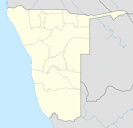 Oranjemund Location in Namibia | |
| Coordinates: 28°33′6″S 16°25′35″E | |
| Country | |
| Region | ǁKaras Region |
| Constituency | Oranjemund Constituency |
| Settled | 1928 |
| Government | |
| • Mayor | Henry Edward Coetzee (SWAPO) |
| Elevation | 39 ft (12 m) |
| Population (2011)[1] | |
| • Total | 3,908 |
| Time zone | UTC+2 (South African Standard Time) |
| Climate | BWk |
History
The entire area along the shore of the Atlantic Ocean was proclaimed restricted (the Sperrgebiet) in 1908 due to the occurrence of alluvial diamonds. Since then the public was forbidden to enter it. In 1927 diamonds were found south of the Orange River in South Africa. Hans Merensky and other prospectors assumed that the northern shore on South West African territory would also have diamonds. A year later they conducted an expedition from Lüderitz 300 kilometres (190 mi) to the mouth of the Orange. They found rich deposits on the north bank of the Orange River and the adjacent northern coastline and established a tent camp from which Oranjemund developed.[2]
Due to the Great Depression, diamond mining was not taken up until 1935, and a year later workers' houses were erected.[2] Oranjemund as a formal settlement was thus established in 1936.[3] Production of mainly gem-quality diamonds has remained in the region of 2 million carats (400 kg) per year since inception of the mine, mainly through improvements in technology.
The town was run by Namdeb (formerly Consolidated Diamond Mines), now a subsidiary of De Beers. Access to, and settlement in Oranjemund was restricted to employees and their relatives. Its infrastructure is superior to that of other towns in Namibia's South, due to it not being dependent on cost recovery from its inhabitants. In the second half of the 20th century, Oranjemund featured a large recreational complex with swimming pool, cinema, restaurants and bars.[4] Water is still provided free of charge, and until 2016 so was electricity.[5]
Transportation
The Oranjemund Airport has services operated by Air Namibia going to Cape Town, Lüderitz, Walvis Bay and Windhoek. There is a border post to South Africa at the south end of the Ernest Oppenheimer Bridge. Only persons with pre-application of 1 month are allowed to cross the border.
Geography
| Oranjemund | ||||||||||||||||||||||||||||||||||||||||||||||||||||||||||||
|---|---|---|---|---|---|---|---|---|---|---|---|---|---|---|---|---|---|---|---|---|---|---|---|---|---|---|---|---|---|---|---|---|---|---|---|---|---|---|---|---|---|---|---|---|---|---|---|---|---|---|---|---|---|---|---|---|---|---|---|---|
| Climate chart (explanation) | ||||||||||||||||||||||||||||||||||||||||||||||||||||||||||||
| ||||||||||||||||||||||||||||||||||||||||||||||||||||||||||||
| ||||||||||||||||||||||||||||||||||||||||||||||||||||||||||||
Climate
Oranjemund has a desert climate (BWk, according to the Köppen climate classification), with pleasant temperatures throughout the year. The average annual precipitation is 50 mm (2 in).
Politics
Oranjemund is governed by a town council that currently has seven seats.[6]
In a by-election of the 2010 local authority election, 2,221 registered voters elected local authority councillors for the first time on 16 March 2012. SWAPO won the elections, and since 23 March 2012 Henry Edward Coetzee is the town's mayor.
References
- "Table 4.2.2 Urban population by Census years (2001 and 2011)" (PDF). Namibia 2011 - Population and Housing Census Main Report. Namibia Statistics Agency. p. 39. Retrieved 24 August 2016.
- Weidlich, Brigitte (20 October 2017). "Oranjemund opens its doors to the world". Gondwana Collection Namibia.
- Hartman, Adam (May 2019). "Evolution of Namibia's mining towns". Mining Journal supplement to The Namibian. pp. 26–33.
- Alexander, Mike. "THE REC CLUB!". oranjemundonline.com. Retrieved 16 March 2011.
- Alexander, Mike. "Paying for Power!". oranjemundonline.com. Retrieved 16 March 2011.
- "Know Your Local Authority". Election Watch (3). Institute for Public Policy Research. 2015. p. 4.
External links
- Oranjemund Town Council, official website
- Oranjemund Online, unofficial website with historic pictures
- Oranjemund weather conditions
| Wikivoyage has a travel guide for Oranjemund. |
| Authority control |
|
|---|