Oranga
Oranga is a small residential suburb in Auckland, New Zealand. It is located nine kilometres to the southeast of the city centre, between the commercial suburbs of Te Papapa and Penrose to the south and east, and the residential suburbs of One Tree Hill and Onehunga to the north and south.
Oranga | |
|---|---|
 Oranga | |
| Coordinates: 36.911505°S 174.802473°E | |
| Country | New Zealand |
| Local authority | Auckland Council |
| Electoral ward | Maungakiekie-Tamaki |
| Local board | Maungakiekie-Tamaki |
| Board subdivision | Maungakiekie |
| Population (2013) | |
| • Total | 4,056 |
| One Tree Hill | Greenlane | Ellerslie |
| Royal Oak |
|
Penrose |
| Onehunga | Onehunga | Te Papapa |
The New Zealand Ministry for Culture and Heritage gives a translation of "place of rising ground" for Ōranga.[1]
Oranga had a population of 4,056 at the 2013 New Zealand census, an increase of 204 people since the 2006 census. There were 1,929 males and 2,127 females.[2] 45.4% were European/Pākehā, 13.3% were Māori, 41.2% were Pacific peoples and 13.3% were Asian.[3]
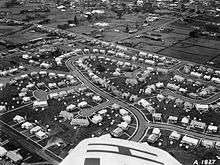
It used to be a state housing neighbourhood for low-income families, but it is rapidly gentrifying. Private investors have bought many of the state houses for renovation, and to subdivide their generous sections. Real estate agents increasingly advertise these houses as belonging to the wealthier suburb of One Tree Hill.
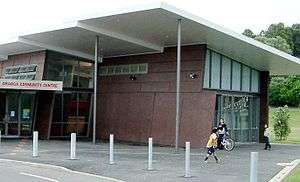
Local facilities include Oranga Kindergarten (neighbouring Fergusson Domain), and Oranga Primary School.[4] The local secondary schools are One Tree Hill College, Marcellin College and Onehunga High School.
References
- "1000 Māori place names". New Zealand Ministry for Culture and Heritage. 6 August 2019.
- 2013 Census QuickStats about a place : Oranga
- 2013 Census QuickStats about a place (Cultural diversity) : Oranga
- Oranga Primary School