Omaruru, Namibia
Omaruru is a city[2] and constituency in the Erongo Region of Namibia. The town has 14,000 inhabitants[3] and owns 352 square kilometres (136 sq mi) of land.[4] The town is situated near Mount Erongo, on the usually dry Omaruru River. It is located on the main paved road from Swakopmund to Otjiwarongo. The name in the local Otjiherero language means 'bitter milk', as the cattle used to browse on a local bush that turned their milk bitter.
Omaruru | |
|---|---|
City | |
 Coat of arms | |
| Motto(s): Belief and Courage | |
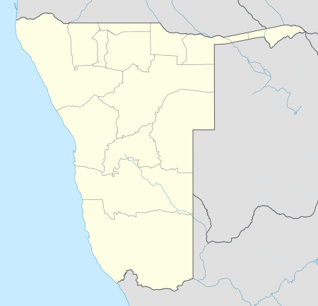 Omaruru Location in Namibia | |
| Coordinates: 21°26′S 15°56′E | |
| Country | |
| Region | Erongo Region |
| Constituency | Omaruru Constituency |
| Established | 1863 |
| Population (2011)[1] | |
| • Total | 6,300 |
| Time zone | UTC+1 (South African Standard Time) |
| Climate | BWh |
The town is known for its annual festival where the Hereros commemorate their past local chiefs, its winery and for the dinosaur footprints at nearby Otjihaenamparero.
History
Omaruru was established in 1863 by Wilhelm Zeraua, the first chief of the White Flag clan of the OvaHerero people.[5] In 1871, Anders Ohlsson and Axel Eriksson established a brewery at Omaruru. Eriksson had also established a trading post, which flourished and by 1878 he employed about forty whites.[6] Eriksson's business was based upon long-distance trading between southern Angola and Cape Colony, which necessitated the establishment of regional trade routes.[7]
The town grew around a mission built in 1872 by Gottlieb Viehe, now a museum, and was attacked in 1904 during the Herero Wars. Franke Tower was later erected to commemorate the relief by Hauptmann Victor Franke's troops of the local garrison that was beleaguered by Herero tribesmen who had risen against the German colonial presence.
Legacy of von Trotha
The descendants of Lothar von Trotha and the von Trotha family travelled to Omaruru in October 2007 by invitation of the royal Herero chiefs and publicly apologised for his role in the Herero genocide. Member of the family Wolf-Thilo von Trotha: "We, the von Trotha family, are deeply ashamed of the terrible events that took place 100 years ago. Human rights were grossly abused that time".[8]
Dutch Reformed Church
Omaruru Reformed Church, the local congregation of the Dutch Reformed Church in South Africa (NGK) was separated from that in Otjiwarongo in March 1, 1941, and included Omaruru, Karibib, Usakos, Kalkfeld, Swakopmund, and Walvis Bay as ward centers. Over the years, six congregations were in turn spun off from the Omaruru one, but the overall numbers were usually sparse given the predominantly German demographics of the local white population. At its founding, the congregation covered an area of approximately 400 kilometres (250 mi), both north to south and east to west.
Politics
Omaruru is governed by a municipal council that currently has seven seats.[9] It is the district capital of the Omaruru Constituency.
Omaruru is one of few Namibian towns where the political opposition is relatively strong. Namibia's ruling party SWAPO won the 2010 local authority election with 847 votes, followed by the Rally for Democracy and Progress (RDP) with 369 votes, the United Democratic Front (UDF) with 308 votes, and National Unity Democratic Organisation (NUDO) with 107 votes.[10] SWAPO also was the strongest party in the 2015 local authority elections, winning four seats in the town council and gaining 1117 votes. The UDF gained two seats (590 votes), and the Democratic Turnhalle Alliance (DTA) obtained one (291 votes).[11]
Transport and infrastructure
Omaruru is the only Namibian town not connected to the NamWater pipeline network. It receives its water from boreholes along the Omaruru River which are managed by the municipality.[12]
Omaruru Railway Station connects the town to the Trans-Namib railway network.
References
- "Table 4.2.2 Urban population by Census years (2001 and 2011)" (PDF). Namibia 2011 - Population and Housing Census Main Report. Namibia Statistics Agency. p. 39. Retrieved 24 August 2016.
- "Local Authorities". Association of Local Authorities in Namibia (ALAN). Archived from the original on 10 June 2013. Retrieved 1 October 2012.
- Kazondovi, Lorraine (12 December 2011). "Racial integration failing at Omaruru". New Era. Archived from the original on 2012-05-27. Retrieved 2011-12-13.
- "ELECTIONS 2010: Erongo regional profile". New Era. 16 November 2010.
- "Quantify German repatriation, Venaani says". The Namibian. NAMPA. 8 October 2014.
- Christison, G. "BEYOND THE PALE: DAMARALAND & OVAMBOLAND" (PDF). Retrieved 19 Nov 2009.
- Sellström, Tor (1999). "Sweden and National Liberation in Southern Africa: Volume 1" (PDF). Nordiska Afrikainstitutet, Uppsala. Retrieved 19 Nov 2009.
- BBC News
- "Know Your Local Authority". Election Watch (3). Institute for Public Policy Research. 2015. p. 4.
- "Press Release Local Authority – Erongo – Omaruru". Electoral Commission of Namibia. Retrieved 24 January 2018.
- "Local elections results". Electoral Commission of Namibia. 28 November 2015. p. 1. Archived from the original on 10 December 2015.
- Hartmann, Adam (2 April 2013). "Omaruru running dry". The Namibian. Archived from the original on 13 April 2013.
| Authority control |
|
|---|