Oberrothorn
The Oberrothorn (3,414 m) is a mountain of the Swiss Pennine Alps, overlooking Zermatt in the canton of Valais. Its summit can be easily reached via a trail on its southern flank, from the Unterrothorn cable car station or from Sunnegga.
| Oberrothorn | |
|---|---|
 View of the summit, looking north | |
| Highest point | |
| Elevation | 3,414 m (11,201 ft) |
| Prominence | 259 m (850 ft) [1] |
| Parent peak | Monte Rosa |
| Coordinates | 46°01′39″N 7°48′46″E |
| Geography | |
 Oberrothorn Location in Switzerland | |
| Location | Valais, Switzerland |
| Parent range | Pennine Alps |
| Climbing | |
| Easiest route | Hike from Unterrothorn |
Claims are often made that the Oberrothorn has one of the highest hiking trails in the Alps,[2] or that it's the highest Alpine summit which can be walked up.[3] Such statements are subjective, but do reflect the mountain's unusual accessibility for an Alpine summit of its height.
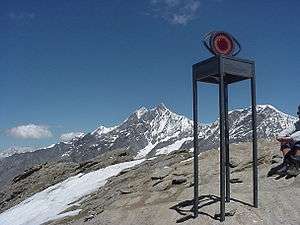
Due to its location to the east of Zermatt, hikers on the main route up and down the mountain are afforded excellent views of the Matterhorn, across the valley, with the popular Hornli Ridge ascent route being prominent.
References
- Swisstopo maps
- "Oberrothorn". Peakware. Retrieved 2015-05-21.
- "Hiking from Unter Rothorn to Ober Rothorn". Retrieved 2015-05-21.
This article is issued from Wikipedia. The text is licensed under Creative Commons - Attribution - Sharealike. Additional terms may apply for the media files.