North Carolina Highway 801
North Carolina Highway 801 (NC 801) is a primary state highway in the U.S. state of North Carolina. The highway runs north–south, traversing the central Piedmont region of the state.
| ||||
|---|---|---|---|---|
 | ||||
| Route information | ||||
| Maintained by NCDOT | ||||
| Length | 53.9 mi[1] (86.7 km) | |||
| Existed | 1927–1928[2]–present | |||
| Major junctions | ||||
| South end | ||||
| North end | ||||
| Location | ||||
| Counties | Iredell, Rowan, Davie | |||
| Highway system | ||||
| ||||

Route description
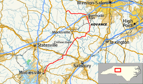
A two-lane rural highway, it traverses 53.9 miles (86.7 km) from Mooresville to U.S. Route 601 (US 601) near Farmington. It links several small towns and communities including Cooleemee, Advance, and Bermuda Run.[1]
History
NC 801 was first commissioned in 1927–28 as a short route traveling east–west from to NC 65 (now US 158) at the now-defunct town of Hillsdale. The route was extended south from its eastern terminus to connect with NC 90 (now US 64) by 1930, becoming a north–south route. In 1933, the route was extended again, from NC 90 southwest to Mooresville, replacing all of NC 803, which ran from US 601 south of Mocksville to NC 26 (now US 29) in Mooresville. Between 1934 and 1936, NC 801 was rerouted in the Hillsdale area, eliminating a concurrency with US 158. In the early 1950s, another short concurrency, with US 64, was replaced with a continuous alignment. When US 70 was shifted onto a new alignment, so did the NC 801 concurrency between 1956 and 1958.[2]
Junction list
| County | Location | mi[1] | km | Destinations | Notes |
|---|---|---|---|---|---|
| Iredell | Mooresville | 0.0 | 0.0 | ||
| 1.5 | 2.4 | ||||
| Rowan | Barber | 14.4 | 23.2 | Southern end of US 70 concurrency | |
| | 15.8 | 25.4 | Northern end of US 70 concurrency | ||
| Davie | Davie Crossroads | 25.0 | 40.2 | ||
| Fork Church | 32.2 | 51.8 | |||
| Bermuda Run | 42.6 | 68.6 | |||
| 42.8– 43.0 | 68.9– 69.2 | Exit 180 (I-40) | |||
| | 53.9 | 86.7 | |||
1.000 mi = 1.609 km; 1.000 km = 0.621 mi
| |||||
References
- Google (2012-01-04). "North Carolina Highway 801" (Map). Google Maps. Google. Retrieved 2012-01-04.
- "NCRoads.com: N.C. 801". Retrieved 2012-01-04.
- "NCRoads.com: N.C. 803". Retrieved 2012-01-04.
External links
| Wikimedia Commons has media related to North Carolina Highway 801. |