Noachis Terra
Noachis Terra (lit. "Land of Noah") is an extensive southern landmass (terra) of the planet Mars. It lies west of the giant Hellas impact basin, roughly between the latitudes −20° and −80° and longitudes 30° west and 30° east, centered on 45°S 350°E. It is in the Noachis quadrangle.
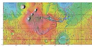
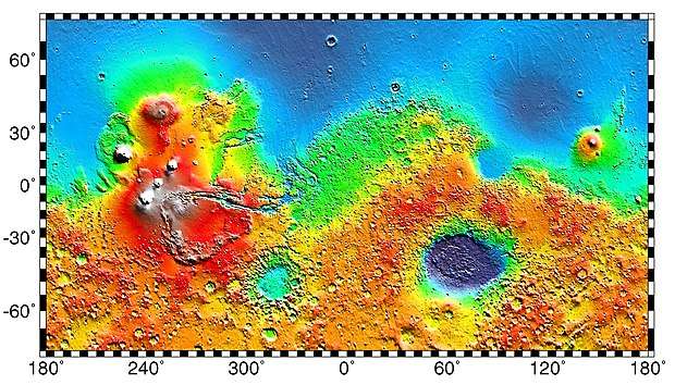
MOLA map showing boundaries with other regions
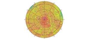
MOLA map showing boundaries with other regions around the south pole of Mars
The term "Noachian epoch" is derived from this region.
Gallery

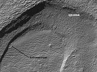 Crater that was buried in another age and is now being exposed by erosion, as seen by the Mars Global Surveyor, under the MOC Public Targeting Program.
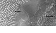 Floor of crater in Noachis quadrangle, as seen by HiRISE under HiWish program.
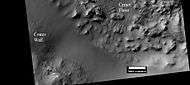 Erosion forms on floor of crater, as seen by HiRISE under HiWish program
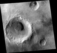 Context for image of dark dunes in next image. Picture taken with Mars Global surveyor under MOC Public Targeting Program.
 Dark dunes (probably basalt), in an intracrater dune field, Noachis. Picture from Mars Global Surveyor, under the MOC Public Targeting Program.
 Wide view of gullies in Arkhangelsky Crater, as seen by HiRISE under HiWish program
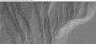 Close-up of small channels in gullies in Arkhangelsky Crater, as seen by HiRISE under HiWish program Patterned ground in the shape of polygons can be seen to the right. Note: this is an enlargement of the previous image from Arkhangelsky Crater.
 Close-up of a gully showing a channel going across the apron, as seen by HiRISE under HiWish program. Note: this is an enlargement of a previous image from Arkhangelsky Crater.
Gullies on Dunes
Gullies are found on some dunes. These are somewhat different than gullies in other places, like the walls of craters. Gullies on dunes seem to keep the same width for a long distance and often just end with a pit, instead of an apron. Many of these gullies are found on dunes in Russell (Martian crater).
 Wide view of dunes in Russell Crater, as seen by HiRISE Many narrow gullies are visible.
 Close view of the end of gullies in Russell Crater, as seen by HiRISE Note: These type of gullies do not usually end with an apron. The location is Noachis quadrangle.
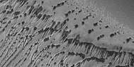 Close view of the end of gullies in Russell Crater, as seen by HiRISE
 Close, color view of the end of gullies in Russell Crater, as seen by HiRISE
Interactive Mars map
(See also: Mars Rovers map and Mars Memorial map) (view • discuss)
Further reading
- Lorenz, R. 2014. The Dune Whisperers. The Planetary Report: 34, 1, 8-14
- Lorenz, R., J. Zimbelman. 2014. Dune Worlds: How Windblown Sand Shapes Planetary Landscapes. Springer Praxis Books / Geophysical Sciences.
- Ruj, T., Komatsu, G., Dohm, J.M., Miyamoto, H. and Salese, F., 2017. Generic identification and classification of morphostructures in the Noachis-Sabaea region, southern highlands of Mars. Journal of Maps, 13(2), pp. 755–766. DOI: 10.1080/17445647.2017.1379913.
- Ruj, T., Komatsu, G., Pasckert, J.H. and Dohm, J.M., 2018. Timings of early crustal activity in southern highlands of Mars: Periods of crustal stretching and shortening. Geoscience Frontiers.
External links
- (in English) ESA Science and Technology: Noachis Terra
This article is issued from Wikipedia. The text is licensed under Creative Commons - Attribution - Sharealike. Additional terms may apply for the media files.