Ngaroto railway station
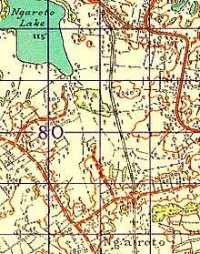
Ngaroto railway station was a station on the North Island Main Trunk in New Zealand, 3.4 km (2.1 mi) south of Lake Rd,[2][3] 2 mi (3.2 km) north of Te Awamutu,[4] beside the entrance to Yarndley's Bush.
Ngaroto railway station | |
|---|---|
| Location | New Zealand |
| Coordinates | 37.981686°S 175.308495°E |
| Elevation | 57 m (187 ft) |
| Line(s) | North Island Main Trunk |
| Distance | Wellington 520.06 km (323.15 mi) |
| History | |
| Opened | 1 July 1880 |
| Closed | 15 December 1957[1] |
| Electrified | June 1988 |

The station opened in 1880 at the same time the NIMT was extended to Te Awamutu, though it wasn't mentioned in the press until postal contracts were being let in 1881.[5] It was staffed until 1887.[6] In the early years it was a vital part of local farm transport.[7] Apart from electrification, the only significant work since then seems to have been in 1928, when a lengthy embankment and raised bridge over the Mangapiko Stream lifted the line about 5 ft (1.5 m), to ease the climb from Te Awamutu to Ngaroto.[8]
Ngaroto only featured in annual reports for 3 years –
| year | tickets | season tickets | staff | ref. |
| 1885 | 380 | 1 | [9] | |
| 1886 | 346 | 1 | [10] | |
| 1887 | 286 | 22 | 1 | [11] |
References
- Juliet Scoble: Names & Opening & Closing Dates of Railway Stations in New Zealand
- New Zealand Railway and Tramway Atlas (First ed.). Quail Map Co. 1965. pp. 3 & 4.
- Pierre, Bill (1981). North Island Main Trunk. Wellington: A.H&A.W Reed. pp. 289–290. ISBN 0589013165.
- Auckland Star, Volume LVIII, Issue 230, 28 September 1926, Page 8 – Main Trunk Blocked. Goods Train Derailed. Leaves Rails at Ngaroto
- Auckland Star, Volume XI, Issue 3163, 8 September 1880, Page 1
- "Page 3 Advertisements Column 4 WAIKATO TIMES". paperspast.natlib.govt.nz. 1 October 1887. Retrieved 2 May 2020.
- New Zealand Herald, Volume XLIII, Issue 13357, 11 December 1906, Page 5 Shortage of Railway Trucks
- New Zealand Herald, Volume LXV, Issue 19947, 16 May 1928, Page 10 Main Trunk Line. Improvement to Gradient. Te Awamutu to Ngaroto
- "Appendix to the Journals of the House of Representatives | 1885 Session I RETURN No. 10. STATEMENT of Revenue and Expenditure of each Station for the Twelve Months ending 31st March, 1885". paperspast.natlib.govt.nz. Retrieved 7 May 2018.
- "Appendix to the Journals of the House of Representatives | 1886 Session I". paperspast.natlib.govt.nz. Retrieved 7 May 2018.
- "Appendix to the Journals of the House of Representatives | 1887 Session I". paperspast.natlib.govt.nz. Retrieved 7 May 2018.
External links
| Preceding station | Historical railways | Following station | ||
|---|---|---|---|---|
| Lake Rd Line open, station closed |
North Island Main Trunk KiwiRail |
Te Awamutu Line open, station closed | ||