New Mexico State Road 32
State Road 32 (NM 32) is a 41.323-mile-long (66.503 km) state highway in Catron County in the U.S. state of New Mexico. It stretches from NM 12 in Apache Creek northward to U.S. Route 60 (US 60) in Quemado.
| ||||
|---|---|---|---|---|
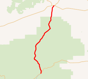
NM 32 highlighted in red | ||||
| Route information | ||||
| Maintained by NMDOT | ||||
| Length | 41.323 mi[1] (66.503 km) | |||
| Major junctions | ||||
| South end | ||||
| North end | ||||
| Location | ||||
| Counties | Catron | |||
| Highway system | ||||
| ||||

Route description
Much of NM 32 runs through the Apache-Sitgreaves National Forest. Its southern terminus is at an intersection with NM 12 in the community of Apache Creek. From there, the road heads north, winding through the Gallo Mountains, before reaching its northern terminus in the town of Quemado at an intersection with US 60.[2]
History
When the state highways were first posted in the early 20th century, NM 32 was originally much longer, extending as far north as Shiprock. When the U.S. Highway System was established in 1926, much of this route was taken over by U.S. Route 666 (now U.S. Route 491). What is now NM 32 is a remnant of the former route that was not renumbered as a U.S. Highway.[3][4]
Major intersections
The entire route is in Catron County.
| Location | mi[5] | km | Destinations | Notes | |
|---|---|---|---|---|---|
| Apache Creek | 0.000 | 0.000 | Southern terminus | ||
| | 33.912 | 54.576 | Western terminus of NM 103; to Quemado Lake[6] | ||
| Quemado | 41.323 | 66.503 | Northern terminus | ||
| 1.000 mi = 1.609 km; 1.000 km = 0.621 mi | |||||
See also

References
- "Posted Route–Legal Description" (PDF). New Mexico Department of Transportation. March 16, 2010. p. 10. Retrieved December 15, 2013.
- The Road Atlas (Map). Rand McNally. 2006. p. 68. § F2, G2. ISBN 0-528-95790-2.
- Rand McNally Auto Road Atlas (Map). Rand McNally (hosted by Broer Map Library). 1926. p. 69. Retrieved 2008-08-04.
- Google Maps (Gallup, NM) (Map). Cartography by NAVTEQ. Google. Retrieved 2008-08-04.
- "TIMS Road Segments by Posted Route/Point with AADT Info; NM, NMX-Routes" (PDF). New Mexico Department of Transportation. April 3, 2013. p. 11. Retrieved December 15, 2013.
- Google (2008-08-04). "overview map of NM 32" (Map). Google Maps. Google. Retrieved 2008-08-04.
External links
![]()