Muna (Umba)
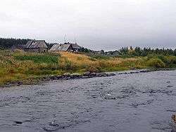
The Muna (Russian: Муна) is a river in the southwestern part on the Kola Peninsula, Murmansk Oblast, Russia. The Muna is a tributary to the river Umba. It is 40 kilometres (25 mi) long, and has a drainage basin of 988 square kilometres (381 sq mi).[1] Its source is Lake Munozero, about 30 km east of Lake Kanozero. From there it flows towards the west, following a winding course through a sparsely populated, hilly landscape dominated by forests and bogs. A substantial tributary, the Inga, flows into the Muna from the north. The Muna's outlet is at the eastern bank of Lake Kanozero, about 8 km southeast of where the river Umba falls into the same lake.
| Muna | |
|---|---|
 | |
| Location | |
| Country | Russia |
| Physical characteristics | |
| Source | Lake Munozero |
| ⁃ coordinates | 67°04′29″N 34°40′36″E |
| Mouth | Lake Kanozero |
⁃ coordinates | 67.0647°N 34.1611°E |
| Length | 40 km (25 mi) |
| Basin size | 988 km2 (381 sq mi) |
| Basin features | |
| Progression | Lake Kanozero→ Umba→ White Sea |
References
- Река Муна in the State Water Register of Russia (Russian)
- Topographical map 1:200000 (Map) (1992 ed.). Russian Federation, Murmansk Oblast. § 22.
This article is issued from Wikipedia. The text is licensed under Creative Commons - Attribution - Sharealike. Additional terms may apply for the media files.