Mudou Island
Mudou Island (Chinese: 目斗嶼; pinyin: Mùdǒu Yǔ) is an island in Baisha Township, Penghu County, Taiwan, part of the Penghu Islands (Pescadores) archipelago.[1][2] It is in the Taiwan Strait off the west coast of Taiwan. The island was formed from plateau basalt.
 | |
 Mudou Island | |
| Geography | |
|---|---|
| Location | Baisha Township, Penghu Islands (Pescadores) archipelago, Taiwan, Taiwan Strait, South China Sea, Pacific Ocean |
| Coordinates | 23.786°N 119.600°E |
| Administration | |
Republic of China (Taiwan) | |
Name
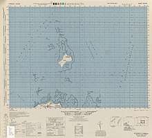
Map including Mudou Island (labeled as Mokuto-shō (Kita-shō)) (1944)

Map including Mudou Island (unlabeled island with 'Light' marking the lighthouse) (1950)
The island was named Mudouyu because the shape resembles an eye of a man or an ink marker of a carpenter.
See also
- Islands of Taiwan
References
- "Mudou Yu: Taiwan". Geographical names. 2012. Retrieved 31 March 2016.
- "GeoNames Search". Geographic Names Database. National Geospatial-Intelligence Agency, USA. Retrieved 31 March 2016.
This article is issued from Wikipedia. The text is licensed under Creative Commons - Attribution - Sharealike. Additional terms may apply for the media files.