Mtamvuna River
Mtamvuna River is a river that forms the border between KwaZulu-Natal and the Eastern Cape Provinces in South Africa. The river has a wide mouth and flows into the Indian Ocean just south of Port Edward. The Mtamvuna river is approximately 162 km long with a catchment area of 1,553 km². The name means "the reaper of mouthfuls" because of the damage the river does to crops during floods.
| Mtamvuna River Umtamvuna | |
|---|---|
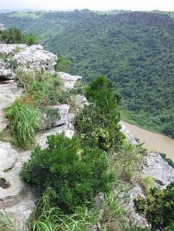 View of the Mtamvuna River Gorge from Clearwater Trail Centre, near Port Edward | |
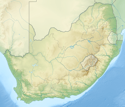 Location of the Mtamvuna River mouth | |
| Etymology | Mtamvuna meaning "the reaper of mouthfuls" in the Xhosa language.[1] |
| Location | |
| Country | South Africa |
| Province | KwaZulu-Natal / Eastern Cape Province |
| Physical characteristics | |
| Source | |
| ⁃ location | Near Weza Forest Reserve, Eastern Cape, South Africa |
| ⁃ elevation | 1,820 m (5,970 ft) |
| Mouth | Indian Ocean |
⁃ location | 5km S of Port Edward, KwaZulu-Natal, South Africa |
⁃ coordinates | 31°4′49″S 30°11′42″E |
⁃ elevation | 0 m (0 ft) |
| Length | 162 km (101 mi) |
| Basin size | 1,553 km2 (600 sq mi) |
Legend says that any person failing to confess his sins before fording the river will be carried away by the water spirits. It is also supposed to be the home of mermaids, who have often been reported playing in the water on moonlit nights.
History
Historically the Mtamvuna River is the northern limit of the Pondoland region.[2]
In 1552 a Portuguese ship ran aground at the mouth of the Mtamvuna River and a group of local people got close to the sailors wishing to trade with them.[3]
Ecology
The Umtamvuna Nature Reserve is a protected area located close to the deep Mtamvuna River Gorge.[4] Presently this river is part of the Mvoti to Umzimkulu Water Management Area.[5]
See also
- List of rivers in South Africa
- List of estuaries of South Africa