Mount William (Antarctica)
Mount William is a prominent snowy mountain in Antarctica, standing 1,600 metres (5,200 ft) tall, and located 6 kilometres (3.7 mi) north-northeast of Cape Lancaster which is the south extremity of Anvers Island, in the Palmer Archipelago. This is the tallest mountain visible from Biscoe Bay, near the south end of the island's Osterrieth Range which also includes Mount Français (the tallest mountain on the island).[2]
| Mount William | |
|---|---|
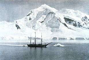 The Belgica anchored at Mount William circa 1898. | |
| Highest point | |
| Elevation | 1,600 m (5,200 ft) [1] |
| Coordinates | 64°47′S 63°41′W [1] |
| Geography | |
| Location | Anvers Island, Antarctica |
This mountain was discovered on February 21, 1832, by John Biscoe who incorrectly believed it to be part of the mainland of Antarctic Peninsula, instead of on an island. He named it for William IV, then King of the United Kingdom.[1]
Mountain climbers from the U.K. were the first to ascend this peak, in 1956. In 2003, after climbing this mountain, two Americans skied down.[3]
A rock ridge leading northwest from Mount William leads to Shewry Peak.
References
- "Mount William". Geographic Names Information System. United States Geological Survey. Retrieved 2007-03-13.
- Taylor, Andrew. Two Years Below the Horn: Operation Tabarin, Field Science, and Antarctic Sovereignty, 1944-1946, p. 116 (Univ. of Manitoba Press, 2017).
- Gildea, Damien. Antarctic Peninsula - Mountaineering in Antarctica: Travel Guide, p. 39 (Primento, 2015).