Mount Conner
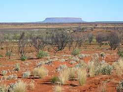
Mount Conner, also known as Attila and Artilla, is a mountain located in the southwest corner of the Northern Territory of Australia, 75 kilometres (47 mi) southeast of Lake Amadeus, in the locality of Petermann[1] and within the Curtin Springs cattle station in Pitjantjatjara country,[2] close to the site of the Kungkarangkalpa (Seven Sisters) Dreaming.[3] Its height reaches 859 metres (2,818 ft) above sea level and 300 metres (984 ft) above ground level.[4]
| Mount Conner | |
|---|---|
 Mount Conner seen from the road to Uluru | |
| Highest point | |
| Elevation | 859 m (2,818 ft) AHD |
| Coordinates | 25°29′34″S 131°53′52″E[1] |
| Naming | |
| Etymology | M. L. Conner |
| Geography | |
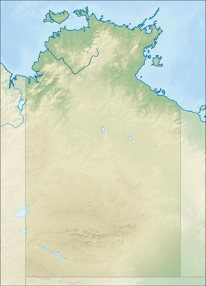 Mount Conner Location in the Northern Territory | |
| Location | Petermann, Northern Territory,[1] Australia |
Geology
The sides of Mount Conner are also blanketed by scree (talus) and its top is blanketed by colluvium. The base of Mount Conner is surrounded by alluvium.[5][6][7]
The summit of Mount Conner, along with the summits of low domes in the Kata Tjuta complex and summit levels of Uluru, is an erosional remnant of a Cretaceous geomorphic surface. It is considered to a classic example of an inselberg created by erosion of surrounding strata.[8]
See also
- List of mountains of the Northern Territory
References
- "Place Names Register Extract for "Mount Conner"". NT Place Names Register. Northern Territory Government. Retrieved 14 June 2019.
- "Central Australia, 1940". SA Memory. State Library of South Australia. 29 October 2009. Retrieved 19 September 2015.
- "Seven Sisters Dreaming". 24 March 2014. Retrieved 19 September 2015.
- "Mount Conner". Encyclopædia Britannica Online. Encyclopædia Britannica. 2011.
- Young, DN, N Duncan, A Camacho, PA Ferenczi, and TLA Madigan (2002a) Ayers Rock, SG 52-8 map, 1:250 000 Geological Series (Second Edition), Northern Territory Geological Survey. scale 1:250 000, Darwin, Northern Territory Geological Survey, Australia.
- Young, DN, N Duncan, A Camacho, PA Ferenczi, and TLA Madigan (2002b) Ayers Rock, SG 52-8 Explanatory Text, 1:250 000 Geological Series (Second Edition). scale 1:250 000, Darwin, Northern Territory Geological Survey, Australia.
- Edgoose, CJ (2012) The Amadeus Basin, central Australia. Episodes. 35(1):257-263.
- Twidale, C.R. (2007) Ancient Australian Landscapes. Rosenberg Publishing, Kenthurst, New South Wales. 144 pp.
| Wikimedia Commons has media related to Mount Conner. |
Additional sources
- Ayers Rock Geology Map (Map) (1st ed.). 1:250,000. Sheet SG52-8. Northern Territory Geological Survey. 1967.
- Ayers Rock Geology Map (Map) (2nd ed.). 1:250,000. Sheet SG52-8. Northern Territory Geological Survey. 2002.
- Johnson, David (2004). The Geology of Australia. Cambridge University Press. ISBN 0-521-84121-6.
Further reading
- Thompson, R B (1995). A Guide to the Geology and Landforms of Central Australia. Alice Springs: Northern Territory Geological Survey. ISBN 0-7245-2527-0.