Mount Agathias
Mount Agathias (Greek: Αγκαθιάς), at 2,424 m, is one of the highest mountains on Crete.[2]
| Mount Agathias | |
|---|---|
| Greek: Αγκαθιάς | |
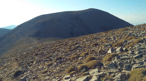 View of the Agathias from west | |
| Highest point | |
| Elevation | 2,424 m (7,953 ft) [1] |
| Prominence | 103 m (338 ft) [1] |
| Coordinates | 35°13′13″N 24°47′01″E |
| Geography | |
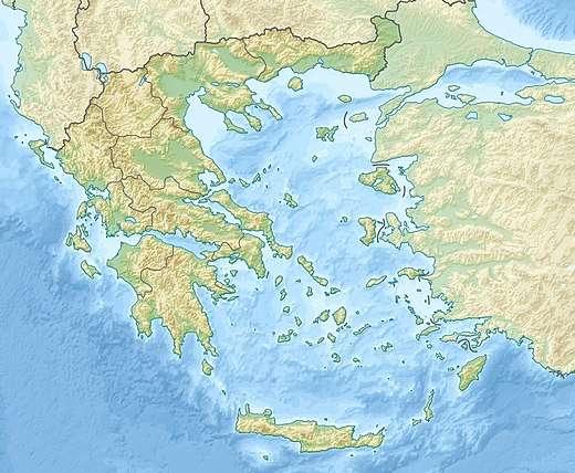 Mount Agathias Location in Greece | |
| Location | Crete, Greece |
| Climbing | |
| First ascent | ancestral |
| Easiest route | hike |
Features

Located in the Rethymno regional unit, the Agathias stands close to the Psiloritis, the highest summit of Mount Ida massif and of the whole island. It belongs to the water divide between the southern part fo Crete, tributary of the Libyan Sea, and the northern one, facing the Aegean sea. A saddle at 2321 m West of mount Agathias connects it with the Psiloritis,[1] while eastwards the ridge continues with Mount Voloumenou.[3] A natural park, member of UNESCO's Global Geoparks Network, includes the Agathias and the Mt. Ida massif as a whole.
Access to the summit
The summit of Mount Agathias can be reached following a track on a rocky terrain branching from the E4 European long distance path.[4]
References
- "Mount Ida, Greece". Peakbagger.com. Retrieved 14 September 2019.
- "Greek Islands:"Mount Agathias height"
- 1:35.000 scale map nr.11.14 – Ψηλορείτης (Agathias) (Map). Anavasi.
- "Mt. Ida (Timios Stavros, 2456m), Agathias (2424m), Vouloumenou (2267m), Kousakas (2211m)". Retrieved 14 September 2019.
![]()