Montana Highway 55
Highway 55 (MT 55) in the U.S. State of Montana is a route running in a northerly direction from an intersection with MT 41 about 4 miles (6.4 km) north of the small town of Silver Star. The highway extends approximately 13 miles (21 km) to an interchange with Interstate 90 (I-90) at the north edge of the town of Whitehall. The route traverses largely agricultural land in the Jefferson River valley.
| ||||
|---|---|---|---|---|
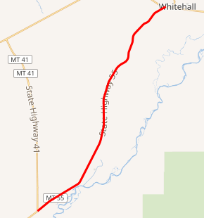
MT 55 highlighted in red | ||||
| Route information | ||||
| Maintained by MDT | ||||
| Length | 12.996 mi[1] (20.915 km) | |||
| Major junctions | ||||
| South end | ||||
| North end | ||||
| Location | ||||
| Counties | Madison, Silver Bow, Jefferson | |||
| Highway system | ||||
| ||||

Route description
Highway 55 begins at MT 41, north of Silver Star. Concurrent with Montana Highway 287, it intersects Cut Across Road. An intersection with Waterloo Road is not far off as Highway 55 proceeds northward. From the west intersects Jack Rabbit Lane, before intersecting Fish Creek Road. It intersects Airport Lane before intersecting Cape Lane. After intersecting several small roads, Highway 55 ends at I-90 at Whitehall.[2]
History
Before receiving its current designation, Highway 55 was designated as part of Montana Highway 287. A small segment of Highway 55 in Whitehall was a former alignment of U.S. Route 10, before U.S. 10 was deleted across Montana.
Major intersections
| County | Location | mi[1] | km | Destinations | Notes | |||
|---|---|---|---|---|---|---|---|---|
| Madison | | 0.000 | 0.000 | |||||
| Silver Bow |
No major junctions | |||||||
| Jefferson | | 12.032 | 19.364 | Western end of MT 2 overlap | ||||
| Whitehall | 12.446 | 20.030 | Eastern end of MT 2 overlap | |||||
| 12.996 | 20.915 | |||||||
1.000 mi = 1.609 km; 1.000 km = 0.621 mi
| ||||||||
References
- Montana Department of Transportation (2013). "Montana Road Log" (PDF). Helena: Montana Department of Transportation. Retrieved April 7, 2017.
- Google (June 8, 2009). "Montana Highway 55" (Map). Google Maps. Google. Retrieved June 8, 2009.
- Official 2007-2008 Montana Highway Travel Map (PDF) (Map). Montana Department of Transportation. Retrieved 2007-12-08.