Mont Brulé
Mont Brulé (also known as Mont Brûlé or Mont Braoulé) is a mountain of the Pennine Alps, located on the Swiss-Italian border, east of the Col Collon. On its northern side it overlooks the upper Arolla Glacier.
| Mont Brulé | |
|---|---|
| Mont Braoulé | |
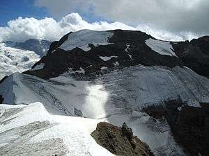 The west side | |
| Highest point | |
| Elevation | 3,578 m (11,739 ft) [1] |
| Prominence | 365 m (1,198 ft) [2] |
| Isolation | 2.33 km (1.45 mi) |
| Coordinates | 45°57′18.8″N 7°32′18.1″E |
| Geography | |
 Mont Brulé Location in the Alps | |
| Location | Valais, Switzerland/Aosta Valley, Italy |
| Parent range | Pennine Alps |
| Climbing | |
| First ascent | 7 August 1876 by Arthur Cust and guide. |
Toponym
Though in French this name means "burnt mountain", this toponym comes from Valdôtain Francoprovençal patois. According to Aostan botanist and scientist Joseph-Marie Henry,[3] the word Broillà means "made of breuils", Breuil meaning alpine marshy berm, as for Breuil in Valtournenche.
References
- "Mont Brulé - Skitour". skitour.fr. Retrieved 14 May 2020.
- Swisstopo map
- Eau, acqua, éve - entre littérature, science et histoire, éd. Duc, Saint-Christophe, p. 96.
This article is issued from Wikipedia. The text is licensed under Creative Commons - Attribution - Sharealike. Additional terms may apply for the media files.