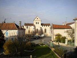
Monsec
Monsec (Limousin: Montsec) is a former commune in the Dordogne department in Nouvelle-Aquitaine in southwestern France. On 1 January 2017, it was merged into the new commune Mareuil en Périgord.[1]
Monsec | |
|---|---|
Part of Mareuil en Périgord | |
 | |
Location of Monsec 
| |
 Monsec  Monsec | |
| Coordinates: 45°25′18″N 0°32′02″E | |
| Country | France |
| Region | Nouvelle-Aquitaine |
| Department | Dordogne |
| Arrondissement | Nontron |
| Canton | Brantôme |
| Commune | Mareuil en Périgord |
| Area 1 | 12.45 km2 (4.81 sq mi) |
| Population (2008) | 181 |
| • Density | 15/km2 (38/sq mi) |
| Time zone | UTC+01:00 (CET) |
| • Summer (DST) | UTC+02:00 (CEST) |
| Postal code | 24340 |
| Elevation | 131–237 m (430–778 ft) (avg. 148 m or 486 ft) |
| 1 French Land Register data, which excludes lakes, ponds, glaciers > 1 km2 (0.386 sq mi or 247 acres) and river estuaries. | |
Geography
Generalities In the Northwest of the Dordogne Department, the county seat of the new commune is Maureil en Périgord. The town is situated along the Belle, a tributary of the Lizonne river. The town of Monsec is situated on the border of the departmental road 939 which connects Périgueux and Angoulême.
Neighboring Municipalities In 2016, the year preceding the creation of the commune of Maureil en Périgord, Monsec was neighbored by five counties. The counties are: Champeaux-et-la-Chapelle-Pommier, Saint-Crépin-de-Richemont, Saint-Félix-de-Bourdeilles, Léguillac-de-Cercles, and Vieux-Mareuil
Population
| Historical population | ||
|---|---|---|
| Year | Pop. | ±% |
| 1962 | 218 | — |
| 1968 | 203 | −6.9% |
| 1975 | 181 | −10.8% |
| 1982 | 168 | −7.2% |
| 1990 | 167 | −0.6% |
| 1999 | 153 | −8.4% |
| 2008 | 181 | +18.3% |
See also
References
- Arrêté préfectoral 26 September 2016 (in French)
| Wikimedia Commons has media related to Monsec. |
| Authority control |
|
|---|