Minnesota State Highway 275
Minnesota State Highway 275 (MN 275) was a 6.519-mile-long (10.491 km) highway in southwest Minnesota, which ran from its intersection with Lac qui Parle County State-Aid Highway 2 in Boyd and continued north to its northern terminus at its intersection with U.S. Highway 212 in Baxter Township, 6 miles east of Dawson. It is now marked as Lac qui Parle County State-Aid Highway 29.
| ||||
|---|---|---|---|---|
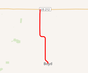
MN 275 highlighted in red | ||||
| Route information | ||||
| Defined by MS § 161.115(206) | ||||
| Maintained by MnDOT | ||||
| Length | 6.519 mi[1] (10.491 km) | |||
| Existed | July 1, 1949[2]–2017[3] | |||
| Major junctions | ||||
| South end | ||||
| North end | ||||
| Location | ||||
| Counties | Lac qui Parle | |||
| Highway system | ||||
| ||||

Route description
Highway 275 served as a north–south connector route in southwest Minnesota between the town of Boyd and U.S. Highway 212.
Highway 275 followed 3rd Street in the town of Boyd.
The route was legally defined as Route 275 in the Minnesota Statutes.[4][5]
History
Highway 275 was authorized on July 1, 1949.[2]
The route was paved in 1954 or 1955.[6][7]
Highway 275 was removed from statute in 2015[5] and given to Lac qui Parle County in 2017 as part of a road exchange,[8] which transferred Lac qui Parle County State-Aid Highway 25 between Highway 40 and US 212 to the state as an extension of Minnesota State Highway 119.[3]
Major intersections
The entire route was in Lac qui Parle County.
| Location | mi[1] | km | Destinations | Notes | |
|---|---|---|---|---|---|
| Boyd | 0.000 | 0.000 | Southern terminus | ||
| 0.603 | 0.970 | ||||
| Ten Mile Lake Township | 3.060 | 4.925 | |||
| Baxter Township | 3.565 | 5.737 | |||
| 6.527 | 10.504 | Northern terminus | |||
| 1.000 mi = 1.609 km; 1.000 km = 0.621 mi | |||||
References
- "Trunk Highway Log Point Listing - Construction District 8" (PDF). Minnesota Department of Transportation. August 23, 2010. Archived from the original (PDF) on December 4, 2008. Retrieved January 23, 2011.
- "Chapter 663-H.F. No. 1792", Session Laws of Minnesota for 1949, Earl L. Berg, Commissioner of Administration, pp. 1177–1185
- "Report on the Jurisdictional Transfer (Turnback) Program" (PDF). Minnesota Department of Transportation. February 2018.
- "161.115, Additional Trunk Highways". Minnesota Statutes. Office of the Revisor of Statutes, State of Minnesota. 2010. Retrieved January 23, 2011.
- "CHAPTER 75--S.F.No. 1647". Minnesota Session Laws - 2015, Regular Session. Minnesota Office of the Revisor of Statutes. May 22, 2015. Sec. 51.
- 1954 Official Road Map of Minnesota (Map). Cartography by The H.M. Gousha Company. Minnesota Department of Highways. January 1, 1954. § D16. Archived from the original on August 25, 2011. Retrieved January 23, 2011.
- 1956 Official Road Map of Minnesota (Map). Cartography by The H.M. Gousha Company. Minnesota Department of Highways. 1956. § D16. Archived from the original on August 25, 2011. Retrieved January 23, 2011.
- Krueger, Andrew (September 14, 2019). "Bye-bye highway: As of Monday, one Minnesota state highway will cease to exist". MPR News. Minnesota Public Radio. Retrieved February 27, 2020.