Minnesota State Highway 127
Minnesota State Highway 127 was a short 2.531-mile-long (4.073 km) connector highway in west-central Minnesota, which ran from its interchange with Interstate 94 in Orange Township northward to its intersection with State Highway 27 in Osakis. The highway was decommissioned when Highway 27 was moved to its alignment.
| ||||
|---|---|---|---|---|
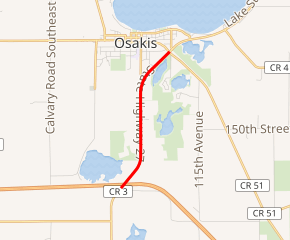
MN 127 highlighted in red | ||||
| Route information | ||||
| Defined by MS § 161.114 | ||||
| Length | 2.531 mi[1] (4.073 km) | |||
| Existed | 1967–2013 | |||
| Major junctions | ||||
| South end | ||||
| North end | ||||
| Location | ||||
| Counties | Douglas | |||
| Highway system | ||||
| ||||

State Highway 127 passed through Orange Township, Osakis Township, and the city of Osakis.
Route description
Highway 127 served as a short north–south connector route between Interstate 94 and State Highway 27 at Osakis.[2]
History
Highway 127 was added to the state highway system in 1967 when I-94 was completed.[3][4][5] I-94 replaced U.S. Highway 52 in west-central Minnesota which had previously run through Osakis and Alexandria in this area.
Concrete paving was done when it became a state highway.[3] Part of the road had previously been County Road 3.[4] The route was part of Minnesota Constitutional Route 3 to (along with Highway 27) maintain the legal definition of that route through Alexandria, although it was not part of that original highway.[6] Highway 127 was numbered as a spur of State Highway 27.
When Highway 27 was moved to overlap I-94 and the previous roadway turned over to Douglas County maintenance in November 2012, Highway 127 was removed, with its signage replaced by 2013. Highway 27 now follows this route.[7]
Major intersections
The entire route was in Douglas County.
| Location | mi[1] | km | Destinations | Notes | |
|---|---|---|---|---|---|
| Orange Township | 0.000– 0.161 | 0.000– 0.259 | Interchange | ||
| Osakis | 1.969 | 3.169 | |||
| 2.562 | 4.123 | ||||
| 1.000 mi = 1.609 km; 1.000 km = 0.621 mi | |||||
References
- "Trunk Highway Log Point Listing - Construction District 4" (PDF). Minnesota Department of Transportation. August 23, 2010. Archived from the original (PDF) on December 4, 2008. Retrieved November 20, 2010.
- Minnesota Department of Transportation, 2005-2006 State Highway Map
- "Construction Project Log Record: Control Section 2113" (PDF). Minnesota Department of Transportation. Retrieved January 1, 2019.
- 1967 Official Road Map - Minnesota (Map). Minnesota Department of Highways. 1967. § E-13. Retrieved January 1, 2019.
- 1968-1969 Official Highway Map - Minnesota (Map). Minnesota Department of Highways. 1968. § E-13. Retrieved January 1, 2019.
- Riner, Steve. "Details of Routes 101-149". The Unofficial Minnesota Highways Page. Retrieved February 24, 2007.
- Chaffins, Amy (November 7, 2012). "Highway 27 Rerouted to I-94". The Osakis Review. Alexandria, MN: Forum Communications. Retrieved January 1, 2019.