Medirigiriya
Medirigiriya (Sinhala: මැදිරිගිරිය) is a town located in Polonnaruwa District in North Central Province, Sri Lanka. The elevation of the town is 61 m (200 ft).[3] The famous archaeological site of Medirigiriya Vatadage is located about 1 km (0.62 mi) from the town centre.[4]
Medirigiriya මැදිරිගිරිය | |
|---|---|
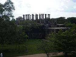 | |
| Medirigiriya Vatadage | |
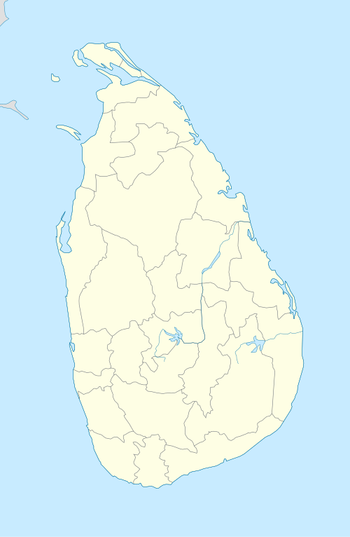 Medirigiriya Location in Sri Lanka | |
| Coordinates: 8°09′02″N 80°58′44″E | |
| Country | Sri Lanka |
| Province | North Central Province |
| District | Polonnaruwa District |
| Elevation | 61 m (200 ft) |
| Time zone | UTC+5:30 (Time in Sri Lanka) |
| Postal code | 51500 [1] |
| Area code(s) | 027 [2] |
3D Heritage Documentation
The Zamani Project, document cultural heritage sites in 3D to create a record for future generations.[5][6][7][8] The documentation is based on terrestrial laser-scanning.[9][10] The 3D documentation of Medirigiriya Watadageya was carried out in 2019.[11] 3D models, a Panorama tour, plans and images can be view here.
See also
- Medirigiriya Vatadage
- Medirigiriya National School
- Medirigiriya Divisional Secretariat
- Medirigiriya Electoral District
References
- "Postal code database". Retrieved 2015-11-24.
- "SLT Area codes in Sri Lanka". Archived from the original on 2015-11-25. Retrieved 2015-11-24.
- "Elevation of Medirigiriya with altitude and height". Retrieved 2015-11-24.
- "medirigiriya Divisional Secretariat - Overview". Retrieved 2015-11-24.
- Rüther, Heinz; Rajan, Rahim S. (2007). "Documenting African Sites: The Aluka Project". Journal of the Society of Architectural Historians. 66 (4): 437–443. doi:10.1525/jsah.2007.66.4.437. ISSN 0037-9808. JSTOR 10.1525/jsah.2007.66.4.437.
- Rüther, Heinz. "AN AFRICAN HERITAGE DATABASE – THE VIRTUAL PRESERVATION OF AFRICA'S PAST" (PDF). isprs.org.
- Giles, Chris. "Meet the scientists immortalizing African heritage in virtual reality". CNN. Retrieved 2019-10-17.
- Wild, Sarah. "Africa's great heritage sites are being mapped out with point precision lasers". Quartz Africa. Retrieved 2019-10-17.
- Rüther, Heinz; Held, Christof; Bhurtha, Roshan; Schroeder, Ralph; Wessels, Stephen (2012-01-13). "From Point Cloud to Textured Model, the Zamani Laser Scanning Pipeline in Heritage Documentation". South African Journal of Geomatics. 1 (1): 44–59–59. ISSN 2225-8531.
- "Challenges in Heritage Documentation with Terrestrial Laser Scanning" (PDF).
- "Site - Medirigiriya". zamaniproject.org. Retrieved 2019-10-17.
This article is issued from Wikipedia. The text is licensed under Creative Commons - Attribution - Sharealike. Additional terms may apply for the media files.