Mayo Bridge
Mayo's Bridge (also known as Richmond's 14th St. Bridge) is located in Richmond, Virginia.[1] A four lane structure, it transports U.S. Route 360 across the James River. Signage identifies the bridge as "Mayo's Bridge."
Mayo's Bridge | |
|---|---|
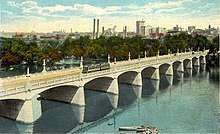 Mayo's Bridge ca. 1917 | |
| Coordinates | 37°31′45″N 77°26′03″W |
| Carries | |
| Crosses | James River |
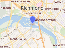
| Locale | Richmond, Virginia |
| Official name | Mayo's Bridge |
| Other name(s) | 14th. St. Bridge; Mayo's Bridge |
| Maintained by | Richmond Dept. of Public Works |
| Characteristics | |
| Total length | 1,374 feet |
| History | |
| Opened | 1913 |
| Statistics | |
| Toll | none |
| |
The bridge is actually in two sections, separated near the middle by Mayo's Island. The total length is 1,374 feet (north and south sections combined). The current structure was built in 1913,[1] and accommodated heavy streetcar traffic. It is Richmond's oldest highway bridge across the James River.
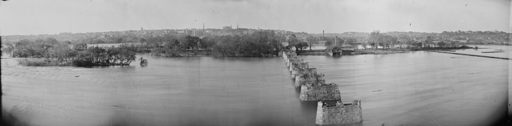
It was built on the site of the city's first bridge completed in 1788 by John Mayo Jr., the grandson of the man who first laid out Richmond's grid pattern. During the American Civil War the bridge was burned by retreating Confederate soldiers on April 8, 1865.[2]
In 1882, the a portion of the bridge collapsed with nine people on it, however, no one was killed or badly hurt in the incident.[2]
Rising just 30 feet above the water line, Mayo's Bridge is currently Richmond's only bridge subject to flooding. Large floodgates in Richmond's Flood wall protect the surrounding areas on each side during James River flooding. The bridge's closeness to the river surface has made the sidewalks on either side of it popular fishing locations.
References
- "106-year-old Mayo Bridge is safe, Richmond officials say". WTVR.com. 2019-03-06. Retrieved 2019-08-31.
- "FALLING OF A BRIDGE SPAN.; A SPACE AND NINE PERSONS CARRIED WITH IT, BUT NO ONE SERIOUSLY INJURED". timesmachine.nytimes.com. Retrieved 2019-08-31.
Crossings of the James River | ||||
|---|---|---|---|---|
| ||||