Big Bend, Eswatini
Big Bend is a town in eastern Eswatini, lying on the Lusutfu River. Its main industry is based on sugar plantations.
Big Bend | |
|---|---|
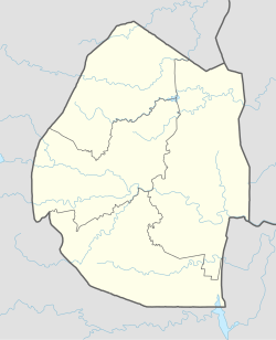 Big Bend Location in Eswatini | |
| Coordinates: 26°49′S 31°56′E | |
| Country | |
| District | Lubombo |
| Elevation | 354 ft (108 m) |
| Time zone | UTC+2 (SAST) |
| Climate | BSh |
Schools
The Edu-care Centre is a preschool which caters to Swazi and expatriate children. Ubombo Primary School and Sisekelo High School are both located in Big Bend. They were established in the late 1970s and have pioneered the high level of teaching excellence in the kingdom that paved the way for other schools to follow.[1]
Climate
Big Bend has a hot semi-arid climate (Köppen: BSh) with very hot and moderately rainy summers and warm, dry winters.
| Climate data for Big Bend | |||||||||||||
|---|---|---|---|---|---|---|---|---|---|---|---|---|---|
| Month | Jan | Feb | Mar | Apr | May | Jun | Jul | Aug | Sep | Oct | Nov | Dec | Year |
| Average high °C (°F) | 32.2 (90.0) |
31.7 (89.1) |
30.6 (87.1) |
29.1 (84.4) |
27.0 (80.6) |
25.2 (77.4) |
25.2 (77.4) |
26.5 (79.7) |
28.4 (83.1) |
29.8 (85.6) |
30.2 (86.4) |
31.6 (88.9) |
29.0 (84.1) |
| Daily mean °C (°F) | 26.2 (79.2) |
26.0 (78.8) |
25.0 (77.0) |
22.8 (73.0) |
19.9 (67.8) |
17.3 (63.1) |
17.1 (62.8) |
19.0 (66.2) |
21.4 (70.5) |
23.4 (74.1) |
24.3 (75.7) |
25.6 (78.1) |
22.3 (72.2) |
| Average low °C (°F) | 20.3 (68.5) |
20.4 (68.7) |
19.5 (67.1) |
16.6 (61.9) |
12.8 (55.0) |
9.4 (48.9) |
9.1 (48.4) |
11.5 (52.7) |
14.5 (58.1) |
17.1 (62.8) |
18.5 (65.3) |
19.6 (67.3) |
15.8 (60.4) |
| Average precipitation mm (inches) | 98 (3.9) |
75 (3.0) |
63 (2.5) |
32 (1.3) |
20 (0.8) |
9 (0.4) |
9 (0.4) |
12 (0.5) |
31 (1.2) |
51 (2.0) |
79 (3.1) |
82 (3.2) |
561 (22.3) |
| Source: Climate-Data.org [2] | |||||||||||||
External links
References
- "eSWATINI (SWAZILAND) SCHOOLS, CHURCHES, COMMUNITY SERVICES". eSwatini Happenings.
- "Climate: Big Bend". Climate-Data.org. Retrieved August 26, 2019.
This article is issued from Wikipedia. The text is licensed under Creative Commons - Attribution - Sharealike. Additional terms may apply for the media files.