Maryland Route 130
Maryland Route 130 (MD 130) is a state highway in the U.S. state of Maryland. Known as Greenspring Valley Road, the state highway runs 5.57 miles (8.96 km) from MD 140 in Garrison east to MD 25 in Brooklandville. MD 130 passes through the Green Spring Valley, an affluent area around the upper reaches of Jones Falls that contains Stevenson University. The state highway was paved by 1910 except for a gap near Stevenson that was closed in the mid-1930s.
| ||||
|---|---|---|---|---|
| Greenspring Valley Road | ||||
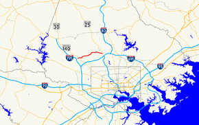 Maryland Route 130 highlighted in red | ||||
| Route information | ||||
| Maintained by MDSHA | ||||
| Length | 5.57 mi[1] (8.96 km) | |||
| Existed | 1927–present | |||
| Major junctions | ||||
| West end | ||||
| East end | ||||
| Location | ||||
| Counties | Baltimore | |||
| Highway system | ||||
| ||||

Route description
_at_Turnlee_Road_in_Garrison%2C_Baltimore_County%2C_Maryland.jpg)
MD 130 begins at an intersection with MD 140 (Reisterstown Road) in Garrison. The state highway heads east as a two-lane undivided road and passes along the edge of the Green Spring Valley Hunt Club and the Green Spring Valley Golf Course, at the edge of which the highway passes through a right-angle curve. MD 130 enters a more rural area and intersects MD 129 (Park Heights Avenue). The state highway passes through the Green Spring Valley Historic District around its intersection with Stevenson Road, which leads south through the hamlet of Stevenson. MD 130 passes through another sharp curve, crosses the North Branch of Jones Falls, passes the main campus of Stevenson University, and passes through a pair of right-angle curves just east of the Gramercy Mansion and west of its junction with Greenspring Avenue. The state highway crosses Dipping Pond Run and passes to the south of St. Paul's School before reaching its eastern terminus with MD 25 (Falls Road) in Brooklandville.[1][2]
History
All of Greenspring Road was paved by 1910 except for a gap at Stevenson Road.[3] That gap in MD 130 was filled in 1934.[4][5] There has been very little change to MD 130 since then.
Junction list
The entire route is in Baltimore County.
| Location | mi [1] | km | Destinations | Notes | |
|---|---|---|---|---|---|
| Garrison | 0.00 | 0.00 | Western terminus | ||
| Stevenson | 1.74 | 2.80 | |||
| Brooklandville | 5.57 | 8.96 | Eastern terminus | ||
| 1.000 mi = 1.609 km; 1.000 km = 0.621 mi | |||||
See also

References
- Highway Information Services Division (December 31, 2013). Highway Location Reference. Maryland State Highway Administration. Retrieved 2012-02-10.
- Baltimore County (PDF).
- Google (2012-02-10). "Maryland Route 130" (Map). Google Maps. Google. Retrieved 2012-02-10.
- Maryland Geological Survey (1910). Map of Maryland (Map). Baltimore: Maryland Geological Survey.
- Byron, William D.; Lacy, Robert (December 28, 1934). Report of the State Roads Commission of Maryland (1931–1934 ed.). Baltimore: Maryland State Roads Commission. p. 320. Retrieved 2012-02-10.
- Maryland Geological Survey (1935). Map of Maryland Showing State Road System: State Aid Roads and Improved County Road Connections (Map). Baltimore: Maryland Geological Survey.