Mangyō Site
Mangyō Site (万行遺跡, Mangyō Iseki) is an archaeological park containing the remnants of a late Yayoi period to late Kofun period settlement located in what is now part of the city of Nanao, Ishikawa in the Hokuriku region of Japan. The site was designated a National Historic Site of Japan in 2003.[1]
万行遺跡 | |
 Mangyō Site  Mangyō Site (Japan) | |
| Location | Nanao, Ishikawa, Japan |
|---|---|
| Region | Hokuriku region |
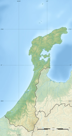
| Coordinates | 37°02′44″N 136°59′35″E |
| Type | Settlement |
| History | |
| Founded | Yayoi to Kofun period |
| Site notes | |
| Ownership | National Historic Site |
| Public access | Yes |
Overview
The site is located one the east side of Noto Peninsula at an altitude of seven meters above the present sea level of Nanao Bay on the Sea of Japan. The cite contains the remnants of many pit dwellings, along with several groups of very large foundation posts, approximately a meter in diameter and depth of 1.6 meters, with a spacing of approximately 4.3 meters between pillars. The number of holes was 60, and from the spatial orientation it was determined that these were the foundations for three large raised-floor structures, each with a surface area of 150 to 320 square meters. It is surmised that these were either warehouses or had a ceremonial or governmental role. Pottery and other artefacts found at the site date it to the late 3rd to early 4th century AD.
References
- "万行遺跡" [Kushidashin Iseki] (in Japanese). Agency for Cultural Affairs.
External links
- Ishikawa Prefectural site (in Japanese)