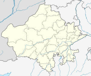
Majal, Barmer
Majal city is a settlement in the east part of Barmer district in the Indian state of Rajasthan. It is south of Luni river,majal is connected to 3 district border (Pali, Jalor, Jodhpur) and 55 km west of the city of Jodhpur.
Majal मजाल
મજલ | |
|---|---|
 Majal Location in Rajasthan, India  Majal Majal (India) | |
| Coordinates: 25.81°N 72.70°E | |
| Country | |
| State | Rajasthan |
| District | Barmer |
| Area | |
| • Urban | 45 km2 (17 sq mi) |
| Population | |
| • City | 23,698 |
| • Density | 96.2/km2 (249/sq mi) |
| Languages | |
| • Official | Hindi |
| Time zone | UTC+5:30 (IST) |
| PIN | 344021
344029 |
| ISO 3166 code | RJ-IN |
| Vehicle registration | RJ-39 |
Demographics
Majal Pincode-344029(now), 344021(now samdari). Had Post office,S.O Majal. According to the 2001 Census, Majal has a population of 12,598 people (6,880 males and 5,718 females). City urban area 45sq km,
- Sheopura, 4 km(south),
- Devnagar, 3 km(south-west),
- Arat, 3 km(nouth-east),
- Aakhriya, 1 km (center),
- Dhand, 1 km (east),
- Chapra (Chapriya), 2 km (south)
- Sanjada Nada, 1.5 km(south),
- Haripura, 2 km(east-south),
- Ramdev Nagar 5 km(south),
- Megh Nagar 2 km(nouth),
- Aakoda 5 km(east), *Devpura. Totel population of 23,698.[1]
References
- "Census of India 2001: Data from the 2001 Census, including cities, villages and towns (Provisional)". Census Commission of India. Retrieved 1 November 2008.
This article is issued from Wikipedia. The text is licensed under Creative Commons - Attribution - Sharealike. Additional terms may apply for the media files.