Maithai jama Haphong
Maithai jama Haphong[1] is the 6th highest peak of Bangladesh. It is located at the south-eastern part of the Chittagong hill tracts in the Bangladesh-India border area. It is not officially recognized by the Bangladesh government. This peak is also the 2nd highest peak of Reng Tlang range after Dumlong. On 7 December 2014, Fahim Hasan from Dhaka, a member of an adventure team BD Explorer[2] with the help of the adjacent local villagers summited the peak of Maithai jama Haphong[3] and measured this peak as 3,174 feet (967 meters)[4] by Garmin GPS device for the first time. The exact geo location of the highest point is N 22°00.714',E 92°35.863'.[5]
| Maithai jama Haphong | |
|---|---|
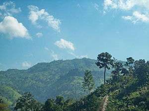 View of Maithai jama Haphong from pukur para trail | |
| Highest point | |
| Elevation | 967.43 m (3,174.0 ft) |
| Prominence | 170 m (560 ft) |
| Isolation | 3 km (1.9 mi) |
| Listing | List of mountains of Bangladesh |
| Coordinates | 22°00′43″N 92°35′52″E |
| Geography | |
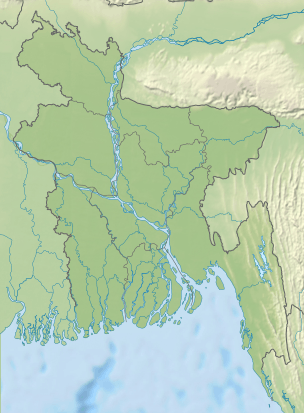 Maithai jama Haphong Geo position of Maithai jama Haphong | |
| Location | Bilaichori Rangamati |
| Parent range | Reng Tlang |
| Geology | |
| Mountain type | Mountain |
On 3 January 2015, during the "Survey South-Eastern zone of Bangladesh 2014-15" led by D-Way Expeditor's team, members measured this peak. Their measured altitude was 3,178 feet (GPS accuracy +/- 10 feet). A few days later, a local trekker named Ratul BD summited the Maithaijama Haphong peak as 3rd team.
The name "Maithai jam Haphong" came from the local Tripura language. It means, "Bad hilly place for vegetation". In the Tripura language "Haphong" means "hill". Stream (jhiri) route to the summit is very adventurous & the view from the peak is extraordinary.[6]
See also
- Geography of Bangladesh
- List of countries by highest point
- List of mountains of Bangladesh
References
- https://www.panoramio.com/map/#lt=22.009621&ln=92.591882&z=1&k=2&a=1&tab=1&pl=all Archived 2014-12-19 at the Wayback Machine
- http://www.wikiloc.com/wikiloc/view.do?id=5657006
- https://www.panoramio.com/photo/114954753
- http://www.wikiloc.com/wikiloc/imgServer.do?id=4944507
- http://www.wikiloc.com/wikiloc/imgServer.do?id=4944507
- https://www.panoramio.com/photo/114953942
External links